Area Overview for ST13 5TL
Photos of ST13 5TL
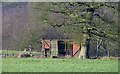
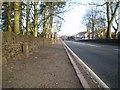
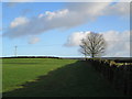
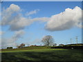

20 photos from this area
Area Information
Key information about the ST13 5TL including its size, population, and administrative classification.
- Area Type
- Postcode
- Area Size
- 5.5 hectares
- Population
- 1676
- Population Density
- 546 people/km²
House Prices in ST13 5TL
58
Properties
£170,928
Average Sold Price
£54,000
Lowest Price
£385,000
Highest Price
Showing 58 properties
| Address | Type | Beds | Baths | Last Sale Price | Last Sale Date | |
|---|---|---|---|---|---|---|
| 20 Mulberry Way, Leek, ST13 5TL | Detached | 3 | 2 | £385,000 | Nov 2024 | |
| 18 Mulberry Way, Leek, ST13 5TL | Detached | 3 | 2 | £312,000 | May 2024 | |
| 27 Mulberry Way, Leek, ST13 5TL | Detached | 3 | 2 | £281,000 | Jun 2023 | |
| 16 Mulberry Way, Leek, ST13 5TL | Detached | 3 | 2 | £322,000 | Sep 2021 | |
| 64 Mulberry Way, Leek, ST13 5TL | house | - | - | £310,000 | Apr 2021 | |
| 42 Mulberry Way, Leek, ST13 5TL | Detached | 4 | 2 | £250,000 | Jul 2020 | |
| Hillside, 68 Mulberry Way, Leek, ST13 5TL | Detached | 4 | 2 | £330,000 | Feb 2020 | |
| 37 Mulberry Way, Leek, ST13 5TL | Detached | 4 | 2 | £263,000 | Feb 2020 | |
| 54 Mulberry Way, Leek, ST13 5TL | Detached | 4 | 2 | £295,000 | Oct 2019 | |
| 44 Mulberry Way, Leek, ST13 5TL | Detached | 3 | 2 | £255,000 | Oct 2019 |
Page 1 of 6
Energy Efficiency in ST13 5TL
Amenities
Schools
| Rank | School | Type | Entry gender | Ages |
|---|
Explore more schools in this area
Go to Schools tabDemographics
Household Size
Two person
most common
Accommodation Type
Houses
most common
Tenure
78
majority
Ethnic Group
White
most common
Religion
N/A
most common
Household Composition
N/A
most common
Age
47
median
Adults (30-64 years)
most common
Household Deprivation
N/A
with no deprivation
NS-SEC
37
in Lower managerial occupations
Explore more demographic insights in this area
Go to Demographics tabPlanning
Planning Constraints
- Flood RiskPremium
- Ramsar Wetland SitesPremium
- Area of Outstanding Natural BeautyPremium
- Protected Nature ReservePremium
- Protected WoodlandPremium