Area Overview for ST13 5PW
Photos of ST13 5PW
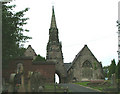

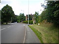
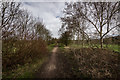
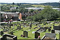
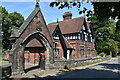
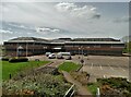
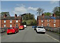
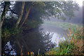
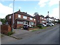
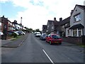
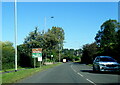
34 photos from this area
Area Information
Key information about the ST13 5PW including its size, population, and administrative classification.
- Area Type
- Postcode
- Area Size
- 6.7 hectares
- Population
- 1511
- Population Density
- 3989 people/km²
House Prices in ST13 5PW
53
Properties
£126,918
Average Sold Price
£43,000
Lowest Price
£200,000
Highest Price
Showing 53 properties
| Address | Type | Beds | Baths | Last Sale Price | Last Sale Date | |
|---|---|---|---|---|---|---|
| 92 Wardle Crescent, Leek, ST13 5PW | Detached | 3 | 1 | £188,000 | Sep 2025 | |
| 38 Wardle Crescent, Leek, ST13 5PW | Semi-detached | 3 | 2 | £200,000 | Aug 2025 | |
| 18 Wardle Crescent, Leek, ST13 5PW | Semi-detached | 3 | 1 | £195,000 | Oct 2024 | |
| 84 Wardle Crescent, Leek, ST13 5PW | Semi-detached | 3 | 1 | £194,500 | Sep 2023 | |
| 48 Wardle Crescent, Leek, ST13 5PW | house | 3 | 1 | £151,500 | Nov 2021 | |
| 46 Wardle Crescent, Leek, ST13 5PW | house | - | - | £165,000 | Sep 2021 | |
| 52 Wardle Crescent, Leek, ST13 5PW | house | 3 | - | £144,000 | May 2021 | |
| 26 Wardle Crescent, Leek, ST13 5PW | Semi-detached | 3 | 1 | £140,000 | May 2021 | |
| 16 Wardle Crescent, Leek, ST13 5PW | Semi-detached | 3 | 1 | £146,000 | Feb 2021 | |
| 90 Wardle Crescent, Leek, ST13 5PW | Semi-detached | 3 | 1 | £145,000 | Jun 2019 |
Page 1 of 6
Energy Efficiency in ST13 5PW
Amenities
Schools
| Rank | School | Type | Entry gender | Ages |
|---|
Explore more schools in this area
Go to Schools tabDemographics
Household Size
Family (3-5 people)
most common
Accommodation Type
Houses
most common
Tenure
68
majority
Ethnic Group
White
most common
Religion
N/A
most common
Household Composition
N/A
most common
Age
47
median
Adults (30-64 years)
most common
Household Deprivation
N/A
with no deprivation
NS-SEC
26
in Lower managerial occupations
Explore more demographic insights in this area
Go to Demographics tabPlanning
Planning Constraints
- Flood RiskPremium
- Ramsar Wetland SitesPremium
- Area of Outstanding Natural BeautyPremium
- Protected Nature ReservePremium
- Protected WoodlandPremium