Area Overview for ST13 5BN
Photos of ST13 5BN
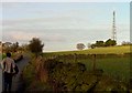
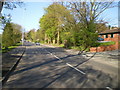
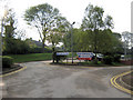
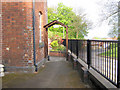
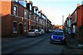

45 photos from this area
Area Information
Key information about the ST13 5BN including its size, population, and administrative classification.
- Area Type
- Postcode
- Area Size
- 1.5 hectares
- Population
- 1468
- Population Density
- 1168 people/km²
House Prices in ST13 5BN
27
Properties
£171,193
Average Sold Price
£40,000
Lowest Price
£328,000
Highest Price
Showing 27 properties
| Address | Type | Beds | Baths | Last Sale Price | Last Sale Date | |
|---|---|---|---|---|---|---|
| Wyngarth, 19 Moorland Road, Leek, ST13 5BN | Detached | 3 | 1 | £328,000 | Sep 2023 | |
| The Croft, 1 Moorland Road, Leek, ST13 5BN | house | - | - | £275,000 | Jun 2021 | |
| 5 Moorland Road, Leek, ST13 5BN | Detached | 3 | 1 | £242,500 | Jun 2016 | |
| 21 Moorland Road, Leek, ST13 5BN | Bungalow | - | - | £50,000 | Nov 2014 | |
| 35 Moorland Road, Leek, ST13 5BN | Semi-detached | 2 | 1 | £165,000 | Jun 2014 | |
| 23 Moorland Road, Leek, ST13 5BN | Bungalow | - | - | £150,000 | Aug 2013 | |
| Manifold House, 9 Moorland Road, Leek, ST13 5BN | house | - | - | £232,000 | Oct 2012 | |
| 41 Moorland Road, Leek, ST13 5BN | Detached | 3 | 1 | £129,950 | Feb 2012 | |
| Janorman, 25 Moorland Road, Leek, ST13 5BN | Bungalow | - | - | £250,000 | Jul 2009 | |
| 33 Moorland Road, Leek, ST13 5BN | Semi-detached | 3 | 2 | £149,000 | Nov 2007 |
Page 1 of 3
Energy Efficiency in ST13 5BN
Amenities
Schools
| Rank | School | Type | Entry gender | Ages |
|---|
Explore more schools in this area
Go to Schools tabDemographics
Household Size
Two person
most common
Accommodation Type
Houses
most common
Tenure
84
majority
Ethnic Group
White
most common
Religion
N/A
most common
Household Composition
N/A
most common
Age
47
median
Adults (30-64 years)
most common
Household Deprivation
N/A
with no deprivation
NS-SEC
31
in Lower managerial occupations
Explore more demographic insights in this area
Go to Demographics tabPlanning
Planning Constraints
- Flood RiskPremium
- Ramsar Wetland SitesPremium
- Area of Outstanding Natural BeautyPremium
- Protected Nature ReservePremium
- Protected WoodlandPremium