Area Overview for ST11 9JG
Photos of ST11 9JG
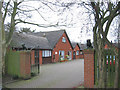


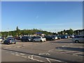
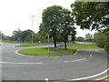
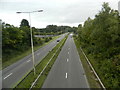
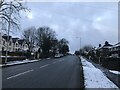
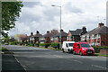
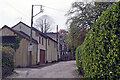
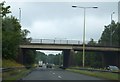
19 photos from this area
Area Information
Key information about the ST11 9JG including its size, population, and administrative classification.
- Area Type
- Postcode
- Area Size
- 14.6 hectares
- Population
- 1619
- Population Density
- 1738 people/km²
House Prices in ST11 9JG
60
Properties
£239,567
Average Sold Price
£46,000
Lowest Price
£520,000
Highest Price
Showing 60 properties
| Address | Type | Beds | Baths | Last Sale Price | Last Sale Date | |
|---|---|---|---|---|---|---|
| 85 Uttoxeter Road, Blythe Bridge, ST11 9JG | Semi-detached | 4 | 1 | £270,000 | Dec 2024 | |
| 74 Uttoxeter Road, Blythe Bridge, Stoke On Trent, ST11 9JG | Semi-detached | 4 | 2 | £335,000 | Aug 2024 | |
| 96 Uttoxeter Road, Blythe Bridge, Stoke On Trent, ST11 9JG | house | - | - | £520,000 | Jun 2022 | |
| Allan House, 53 Uttoxeter Road, Blythe Bridge, ST11 9JG | hospital_care_home | - | - | £500,000 | Dec 2021 | |
| 89 Uttoxeter Road, Blythe Bridge, ST11 9JG | house | - | - | £270,000 | Dec 2020 | |
| 54 Uttoxeter Road, Blythe Bridge, Stoke On Trent, ST11 9JG | Detached | 5 | 3 | £325,000 | Aug 2019 | |
| 48 Uttoxeter Road, Blythe Bridge, Stoke On Trent, ST11 9JG | Detached | 4 | 2 | £245,000 | Jul 2019 | |
| 76 Uttoxeter Road, Blythe Bridge, Stoke On Trent, ST11 9JG | Semi-detached | 4 | 2 | £180,000 | Jan 2019 | |
| Cygnet Learning Disabilities Midlands Ltd, 86 Uttoxeter Road, Blythe Bridge, Stoke On Trent, ST11 9JG | Semi-detached | 5 | 4 | £405,000 | Nov 2018 | |
| Cygnet Learning Disabilities Midlands Ltd, 78 Uttoxeter Road, Blythe Bridge, Stoke On Trent, ST11 9JG | Detached | 6 | 4 | £485,000 | Nov 2018 |
Page 1 of 6
Energy Efficiency in ST11 9JG
Amenities
Schools
| Rank | School | Type | Entry gender | Ages |
|---|
Explore more schools in this area
Go to Schools tabDemographics
Household Size
Two person
most common
Accommodation Type
Houses
most common
Tenure
89
majority
Ethnic Group
White
most common
Religion
N/A
most common
Household Composition
N/A
most common
Age
47
median
Adults (30-64 years)
most common
Household Deprivation
N/A
with no deprivation
NS-SEC
34
in Lower managerial occupations
Explore more demographic insights in this area
Go to Demographics tabPlanning
Planning Constraints
- Flood RiskPremium
- Ramsar Wetland SitesPremium
- Area of Outstanding Natural BeautyPremium
- Protected Nature ReservePremium
- Protected WoodlandPremium