Area Overview for ST10 4SW
Photos of ST10 4SW
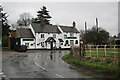
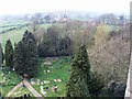
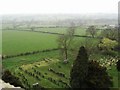
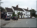
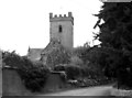
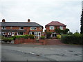
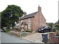

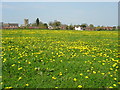
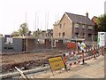

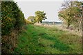
21 photos from this area
Area Information
Key information about the ST10 4SW including its size, population, and administrative classification.
- Area Type
- Postcode
- Area Size
- 18.5 hectares
- Population
- 1277
- Population Density
- 30 people/km²
House Prices in ST10 4SW
17
Properties
£533,667
Average Sold Price
£275,000
Lowest Price
£737,500
Highest Price
Showing 17 properties
| Address | Type | Beds | Baths | Last Sale Price | Last Sale Date | |
|---|---|---|---|---|---|---|
| Hill Crest, Withington Lane, Withington, ST10 4SW | Detached | 3 | 2 | £650,000 | May 2023 | |
| Little Headlands Barn, Withington Lane, Withington, ST10 4SW | house | - | - | £737,500 | Mar 2022 | |
| Florence House, Withington Lane, Withington, ST10 4SW | house | - | - | £560,000 | Sep 2020 | |
| Ryecroft House, Withington Lane, Withington, ST10 4SW | house | - | - | £465,000 | Feb 2018 | |
| Hilltop House, Withington Lane, Withington, ST10 4SW | Semi-detached | 3 | - | £275,000 | May 2016 | |
| Little Headlands Farm, Withington Lane, Withington, ST10 4SW | Detached | 5 | 5 | £514,500 | Feb 2011 | |
| Hallcroft, Withington Lane, Withington, ST10 4SW | Land | - | - | - | - | |
| Autumn House, Withington Lane, Withington, ST10 4SW | Detached | - | - | - | - | |
| Stonehouse Farm, Withington Lane, Withington, ST10 4SW | Detached | - | - | - | - | |
| Orchard View, Withington Lane, Withington, ST10 4SW | Detached | - | - | - | - |
Page 1 of 2
Energy Efficiency in ST10 4SW
Amenities
Schools
| Rank | School | Type | Entry gender | Ages |
|---|
Explore more schools in this area
Go to Schools tabDemographics
Household Size
Two person
most common
Accommodation Type
Houses
most common
Tenure
87
majority
Ethnic Group
White
most common
Religion
N/A
most common
Household Composition
N/A
most common
Age
47
median
Adults (30-64 years)
most common
Household Deprivation
N/A
with no deprivation
NS-SEC
37
in Lower managerial occupations
Explore more demographic insights in this area
Go to Demographics tabPlanning
Planning Constraints
- Flood RiskPremium
- Ramsar Wetland SitesPremium
- Area of Outstanding Natural BeautyPremium
- Protected Nature ReservePremium
- Protected WoodlandPremium