Area Overview for ST10 4QH
Photos of ST10 4QH
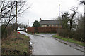
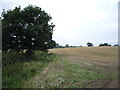
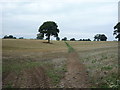
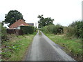
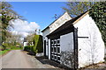
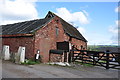
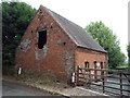
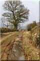
10 photos from this area
Area Information
Key information about the ST10 4QH including its size, population, and administrative classification.
- Area Type
- Postcode
- Area Size
- 98.4 hectares
- Population
- 1277
- Population Density
- 30 people/km²
House Prices in ST10 4QH
11
Properties
-
Average Sold Price
-
Lowest Price
-
Highest Price
Showing 11 properties
| Address | Type | Beds | Baths | Last Sale Price | Last Sale Date | |
|---|---|---|---|---|---|---|
| Dagdale Barn, Upper Nobut Farm, Nobut Road, Nobut, ST10 4QH | Semi-detached | 3 | 2 | - | - | |
| Yew Tree Barn, Upper Nobut Farm, Nobut Road, Nobut, ST10 4QH | Semi-detached | 4 | 3 | - | - | |
| Upper Nobut Farm, Nobut Road, Nobut, ST10 4QH | Semi-detached | 2 | - | - | - | |
| Orchard Barn, Upper Nobut Farm, Nobut Road, Nobut, ST10 4QH | Bungalow | - | - | - | - | |
| The Granary, Upper Nobut Farm, Nobut Road, Nobut, ST10 4QH | house | - | - | - | - | |
| Al's Snack Bar (third Layby Past Jcb), A 50 From Ashbourne Road Roundabout B 5030 To East Staffordshire Borough Council Boundary, Uttoxeter, ST10 4QH | Restaurant | - | - | - | - | |
| The Bungalow, Nobut Road, Nobut, ST10 4QH | Bungalow | - | - | - | - | |
| Crossways Farm, Nobut Road, Nobut, ST10 4QH | Detached | - | - | - | - | |
| Nobut Cottage, Nobut Road, Nobut, ST10 4QH | house | - | - | - | - | |
| High Farm, Nobut Road, Nobut, ST10 4QH | Detached | - | - | - | - |
Page 1 of 2
Energy Efficiency in ST10 4QH
Amenities
Schools
| Rank | School | Type | Entry gender | Ages |
|---|
Explore more schools in this area
Go to Schools tabDemographics
Household Size
Two person
most common
Accommodation Type
Houses
most common
Tenure
87
majority
Ethnic Group
White
most common
Religion
N/A
most common
Household Composition
N/A
most common
Age
47
median
Adults (30-64 years)
most common
Household Deprivation
N/A
with no deprivation
NS-SEC
37
in Lower managerial occupations
Explore more demographic insights in this area
Go to Demographics tabPlanning
Planning Constraints
- Flood RiskPremium
- Ramsar Wetland SitesPremium
- Area of Outstanding Natural BeautyPremium
- Protected Nature ReservePremium
- Protected WoodlandPremium