Area Overview for ST10 4PG
Photos of ST10 4PG
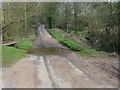
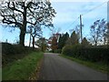
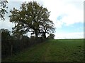
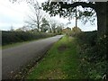
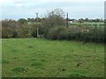
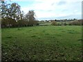
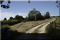
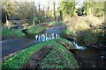
8 photos from this area
Area Information
Key information about the ST10 4PG including its size, population, and administrative classification.
- Area Type
- Postcode
- Area Size
- 49.9 hectares
- Population
- 1919
- Population Density
- 36 people/km²
House Prices in ST10 4PG
16
Properties
£501,500
Average Sold Price
£365,000
Lowest Price
£611,000
Highest Price
Showing 16 properties
| Address | Type | Beds | Baths | Last Sale Price | Last Sale Date | |
|---|---|---|---|---|---|---|
| Heathy Grove Farm, Morrilow Heath Road, Morrilow Heath, Stoke On Trent, ST10 4PG | Detached | - | - | £611,000 | Oct 2020 | |
| Cherrystone Cottage, Morrilow Heath Road, Morrilow Heath, Stoke On Trent, ST10 4PG | Detached | 5 | 2 | £580,000 | Sep 2019 | |
| Hawthorne Farm, Morrilow Heath Road, Morrilow Heath, Stoke On Trent, ST10 4PG | Detached | 5 | 2 | £450,000 | Dec 2006 | |
| Bowers Croft, Milwich Heath Road, Milwich Heath, Stoke On Trent, ST10 4PG | Detached | 4 | - | £365,000 | Jun 2002 | |
| Whitelow Brooks, Wheatlow Brooks Road, Milwich, Stafford, ST10 4PG | undefined | - | - | - | - | |
| Clematis Cottage, Wheatlow Brooks Road, Milwich, Stafford, ST10 4PG | undefined | - | - | - | - | |
| Btj Drives And Controls Ltd, Milwich Heath Road, Milwich Heath, Stoke On Trent, ST10 4PG | house | - | - | - | - | |
| Oldacre, Milwich Heath Road, Milwich Heath, Stoke On Trent, ST10 4PG | Detached | - | - | - | - | |
| Wheatlow Knowles, Milwich Heath Road, Milwich Heath, Stoke On Trent, ST10 4PG | house | - | - | - | - | |
| The Hollies, Milwich Heath Road, Milwich Heath, Stoke On Trent, ST10 4PG | Detached | - | - | - | - |
Page 1 of 2
Energy Efficiency in ST10 4PG
Amenities
Schools
| Rank | School | Type | Entry gender | Ages |
|---|
Explore more schools in this area
Go to Schools tabDemographics
Household Size
Two person
most common
Accommodation Type
Houses
most common
Tenure
76
majority
Ethnic Group
White
most common
Religion
N/A
most common
Household Composition
N/A
most common
Age
47
median
Adults (30-64 years)
most common
Household Deprivation
N/A
with no deprivation
NS-SEC
42
in Lower managerial occupations
Explore more demographic insights in this area
Go to Demographics tabPlanning
Planning Constraints
- Flood RiskPremium
- Ramsar Wetland SitesPremium
- Area of Outstanding Natural BeautyPremium
- Protected Nature ReservePremium
- Protected WoodlandPremium