Area Overview for ST10 4NJ
Photos of ST10 4NJ
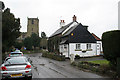
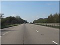
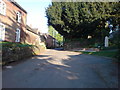
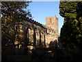
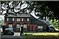

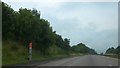


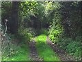
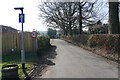
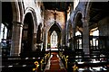
12 photos from this area
Area Information
Key information about the ST10 4NJ including its size, population, and administrative classification.
- Area Type
- Postcode
- Area Size
- 8.6 hectares
- Population
- 1300
- Population Density
- 87 people/km²
House Prices in ST10 4NJ
42
Properties
£218,467
Average Sold Price
£2,000
Lowest Price
£450,000
Highest Price
Showing 42 properties
| Address | Type | Beds | Baths | Last Sale Price | Last Sale Date | |
|---|---|---|---|---|---|---|
| Dunnys Cottage, Church Lane, Checkley, ST10 4NJ | Land | - | - | £310,000 | Jun 2021 | |
| Kinroy, 16 Church Lane, Checkley, ST10 4NJ | Bungalow | - | - | £325,000 | May 2021 | |
| 54 Church Lane, Checkley, ST10 4NJ | house | - | - | £285,000 | Mar 2021 | |
| 32 Church Lane, Checkley, ST10 4NJ | house | - | - | £215,000 | Nov 2020 | |
| Church Cottage, 14 Church Lane, Checkley, ST10 4NJ | Semi-detached | - | - | £2,000 | Sep 2020 | |
| 20 Church Lane, Checkley, ST10 4NJ | Detached | 3 | 1 | £355,000 | Oct 2019 | |
| 34 Church Lane, Checkley, ST10 4NJ | Semi-detached | 2 | 2 | £190,000 | Nov 2017 | |
| Kyrenia, 19 Church Lane, Checkley, ST10 4NJ | Detached | 3 | 1 | £190,000 | Sep 2014 | |
| Walnut House, Church Lane, Checkley, ST10 4NJ | Detached | - | - | £291,000 | Jul 2008 | |
| 17 Church Lane, Checkley, ST10 4NJ | Detached | - | - | £202,000 | Aug 2006 |
Page 1 of 5
Energy Efficiency in ST10 4NJ
Amenities
Schools
| Rank | School | Type | Entry gender | Ages |
|---|
Explore more schools in this area
Go to Schools tabDemographics
Household Size
Two person
most common
Accommodation Type
Houses
most common
Tenure
88
majority
Ethnic Group
White
most common
Religion
N/A
most common
Household Composition
N/A
most common
Age
47
median
Adults (30-64 years)
most common
Household Deprivation
N/A
with no deprivation
NS-SEC
38
in Lower managerial occupations
Explore more demographic insights in this area
Go to Demographics tabPlanning
Planning Constraints
- Flood RiskPremium
- Ramsar Wetland SitesPremium
- Area of Outstanding Natural BeautyPremium
- Protected Nature ReservePremium
- Protected WoodlandPremium