Area Overview for ST10 3EP
Photos of ST10 3EP
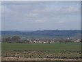
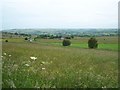
![The Casey [or causeway] in ST10 3EP](https://images.propbar.co.uk/images/geograph/29/66/2966775_120.jpg)
17 photos from this area
Area Information
Key information about the ST10 3EP including its size, population, and administrative classification.
- Area Type
- Postcode
- Area Size
- 92.2 hectares
- Population
- 1743
- Population Density
- 27 people/km²
House Prices in ST10 3EP
39
Properties
£189,062
Average Sold Price
£56,500
Lowest Price
£760,000
Highest Price
Showing 39 properties
| Address | Type | Beds | Baths | Last Sale Price | Last Sale Date | |
|---|---|---|---|---|---|---|
| 65 Stoney Lane, Cauldon, ST10 3EP | Terraced | 3 | 1 | £59,127 | Sep 2025 | |
| 62 Stoney Lane, Cauldon, ST10 3EP | Terraced | 3 | 1 | £179,000 | Jan 2025 | |
| 52 Stoney Lane, Cauldon, ST10 3EP | Semi-detached | 3 | 1 | £190,000 | Mar 2024 | |
| 69 Stoney Lane, Cauldon, ST10 3EP | house | - | - | £228,350 | Mar 2023 | |
| 46 Stoney Lane, Cauldon, ST10 3EP | Terraced | 2 | 1 | £170,000 | Aug 2022 | |
| 68 Stoney Lane, Cauldon, ST10 3EP | house | - | - | £180,000 | Feb 2022 | |
| 66 Stoney Lane, Cauldon, ST10 3EP | house | - | - | £167,000 | Feb 2022 | |
| 59 Stoney Lane, Cauldon, ST10 3EP | house | - | - | £189,950 | Dec 2020 | |
| 53 Stoney Lane, Cauldon, ST10 3EP | house | - | - | £185,000 | Nov 2020 | |
| 49 Stoney Lane, Cauldon, ST10 3EP | Terraced | 3 | 1 | £186,000 | Aug 2020 |
Page 1 of 4
Energy Efficiency in ST10 3EP
Amenities
Schools
| Rank | School | Type | Entry gender | Ages |
|---|
Explore more schools in this area
Go to Schools tabDemographics
Household Size
Two person
most common
Accommodation Type
Houses
most common
Tenure
81
majority
Ethnic Group
White
most common
Religion
N/A
most common
Household Composition
N/A
most common
Age
47
median
Adults (30-64 years)
most common
Household Deprivation
N/A
with no deprivation
NS-SEC
33
in Lower managerial occupations
Explore more demographic insights in this area
Go to Demographics tabPlanning
Planning Constraints
- Flood RiskPremium
- Ramsar Wetland SitesPremium
- Area of Outstanding Natural BeautyPremium
- Protected Nature ReservePremium
- Protected WoodlandPremium