Area Overview for ST10 2PF
Photos of ST10 2PF
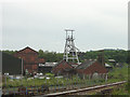


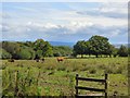


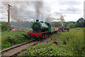
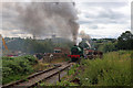
46 photos from this area
Area Information
Key information about the ST10 2PF including its size, population, and administrative classification.
- Area Type
- Postcode
- Area Size
- 66.9 hectares
- Population
- 1776
- Population Density
- 77 people/km²
House Prices in ST10 2PF
44
Properties
£220,920
Average Sold Price
£33,000
Lowest Price
£432,000
Highest Price
Showing 44 properties
| Address | Type | Beds | Baths | Last Sale Price | Last Sale Date | |
|---|---|---|---|---|---|---|
| School House, Godley Lane, Dilhorne, ST10 2PF | Detached | 4 | 2 | £400,000 | Mar 2025 | |
| Bank House, Godley Lane, Dilhorne, ST10 2PF | Semi-detached | 3 | 1 | £290,000 | Mar 2024 | |
| Beech Cottage, Godley Lane, Dilhorne, ST10 2PF | Detached | 3 | 2 | £432,000 | May 2023 | |
| 32 Godley Lane, Dilhorne, ST10 2PF | house | - | - | £155,000 | Jul 2021 | |
| Red House, Godley Lane, Dilhorne, ST10 2PF | house | - | - | £382,000 | Mar 2021 | |
| 11 Godley Lane, Dilhorne, ST10 2PF | house | - | - | £200,000 | Mar 2021 | |
| Holmlea, Godley Lane, Dilhorne, ST10 2PF | Detached | 4 | 2 | £345,000 | Aug 2018 | |
| 6 Godley Lane, Dilhorne, ST10 2PF | Semi-detached | 3 | - | £165,000 | Apr 2017 | |
| Ash Cottage, Godley Lane, Dilhorne, ST10 2PF | Semi-detached | 3 | 1 | £323,000 | Nov 2016 | |
| 97 Godley Lane, Dilhorne, ST10 2PF | house | 3 | 1 | £185,000 | Jul 2016 |
Page 1 of 5
Energy Efficiency in ST10 2PF
Amenities
Schools
| Rank | School | Type | Entry gender | Ages |
|---|
Explore more schools in this area
Go to Schools tabDemographics
Household Size
Two person
most common
Accommodation Type
Houses
most common
Tenure
84
majority
Ethnic Group
White
most common
Religion
N/A
most common
Household Composition
N/A
most common
Age
47
median
Adults (30-64 years)
most common
Household Deprivation
N/A
with no deprivation
NS-SEC
30
in Lower managerial occupations
Explore more demographic insights in this area
Go to Demographics tabPlanning
Planning Constraints
- Flood RiskPremium
- Ramsar Wetland SitesPremium
- Area of Outstanding Natural BeautyPremium
- Protected Nature ReservePremium
- Protected WoodlandPremium