Area Overview for ST10 2AG
Photos of ST10 2AG
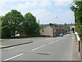
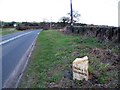
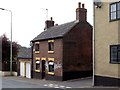
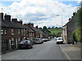
5 photos from this area
Area Information
Key information about the ST10 2AG including its size, population, and administrative classification.
- Area Type
- Postcode
- Area Size
- 8203 m²
- Population
- 1499
- Population Density
- 169 people/km²
House Prices in ST10 2AG
33
Properties
£129,631
Average Sold Price
£35,000
Lowest Price
£406,000
Highest Price
Showing 33 properties
| Address | Type | Beds | Baths | Last Sale Price | Last Sale Date | |
|---|---|---|---|---|---|---|
| 53 The Green, Kingsley, ST10 2AG | Detached | 3 | 2 | £235,000 | Jun 2024 | |
| 17 The Green, Kingsley, ST10 2AG | Terraced | 2 | 1 | £130,000 | Sep 2023 | |
| 5 The Green, Kingsley, ST10 2AG | Terraced | 1 | 1 | £120,000 | May 2023 | |
| 61 The Green, Kingsley, ST10 2AG | house | - | - | £115,000 | Dec 2022 | |
| Rock Cottage, 1 The Green, Kingsley, ST10 2AG | Detached | 4 | 1 | £406,000 | Sep 2022 | |
| 3 The Green, Kingsley, ST10 2AG | Terraced | 2 | 1 | £103,000 | Jun 2022 | |
| 49 The Green, Kingsley, ST10 2AG | house | - | - | £116,000 | Aug 2021 | |
| 15 The Green, Kingsley, ST10 2AG | Terraced | 2 | 1 | £106,000 | Jul 2021 | |
| 37 The Green, Kingsley, ST10 2AG | house | - | - | £145,000 | Nov 2020 | |
| 35 The Green, Kingsley, ST10 2AG | Terraced | 3 | 1 | £140,000 | Jun 2020 |
Page 1 of 4
Energy Efficiency in ST10 2AG
Amenities
Schools
| Rank | School | Type | Entry gender | Ages |
|---|
Explore more schools in this area
Go to Schools tabDemographics
Household Size
Two person
most common
Accommodation Type
Houses
most common
Tenure
80
majority
Ethnic Group
White
most common
Religion
N/A
most common
Household Composition
N/A
most common
Age
47
median
Adults (30-64 years)
most common
Household Deprivation
N/A
with no deprivation
NS-SEC
27
in Lower managerial occupations
Explore more demographic insights in this area
Go to Demographics tabPlanning
Planning Constraints
- Flood RiskPremium
- Ramsar Wetland SitesPremium
- Area of Outstanding Natural BeautyPremium
- Protected Nature ReservePremium
- Protected WoodlandPremium