Area Overview for ST1 6PS
Photos of ST1 6PS


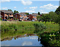
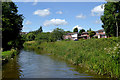
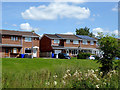
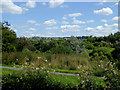


29 photos from this area
Area Information
Key information about the ST1 6PS including its size, population, and administrative classification.
- Area Type
- Postcode
- Area Size
- 3814 m²
- Population
- 1555
- Population Density
- 4698 people/km²
House Prices in ST1 6PS
22
Properties
£64,541
Average Sold Price
£30,000
Lowest Price
£118,000
Highest Price
Showing 22 properties
| Address | Type | Beds | Baths | Last Sale Price | Last Sale Date | |
|---|---|---|---|---|---|---|
| 88 Prime Street, Hanley, Stoke On Trent, ST1 6PS | house | - | - | £93,000 | Feb 2022 | |
| 90 Prime Street, Hanley, Stoke On Trent, ST1 6PS | house | 3 | - | £101,250 | Sep 2021 | |
| 104 Prime Street, Hanley, Stoke On Trent, ST1 6PS | Terraced | 2 | 1 | £95,000 | Aug 2021 | |
| 122 Prime Street, Hanley, Stoke On Trent, ST1 6PS | house | - | - | £65,000 | Nov 2020 | |
| 82 Prime Street, Hanley, Stoke On Trent, ST1 6PS | Semi-detached | 2 | 1 | £118,000 | Jun 2018 | |
| 92 Prime Street, Hanley, Stoke On Trent, ST1 6PS | Terraced | 2 | 1 | £45,000 | Mar 2018 | |
| 94 Prime Street, Hanley, Stoke On Trent, ST1 6PS | Semi-detached | 2 | 1 | £60,000 | Sep 2017 | |
| 124 Prime Street, Hanley, Stoke On Trent, ST1 6PS | Terraced | 2 | 1 | £60,500 | Nov 2015 | |
| 84 Prime Street, Hanley, Stoke On Trent, ST1 6PS | Semi-detached | 2 | 1 | £64,000 | Nov 2015 | |
| 108 Prime Street, Hanley, Stoke On Trent, ST1 6PS | house | - | - | £74,000 | Feb 2014 |
Page 1 of 3
Energy Efficiency in ST1 6PS
Amenities
Schools
| Rank | School | Type | Entry gender | Ages |
|---|
Explore more schools in this area
Go to Schools tabDemographics
Household Size
One person
most common
Accommodation Type
Houses
most common
Tenure
53
majority
Ethnic Group
White
most common
Religion
N/A
most common
Household Composition
N/A
most common
Age
47
median
Adults (30-64 years)
most common
Household Deprivation
N/A
with no deprivation
NS-SEC
18
in Lower managerial occupations
Explore more demographic insights in this area
Go to Demographics tabPlanning
Planning Constraints
- Flood RiskPremium
- Ramsar Wetland SitesPremium
- Area of Outstanding Natural BeautyPremium
- Protected Nature ReservePremium
- Protected WoodlandPremium