Area Overview for ST1 6DE
Photos of ST1 6DE
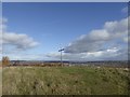
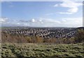
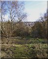
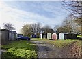
40 photos from this area
Area Information
Key information about the ST1 6DE including its size, population, and administrative classification.
- Area Type
- Postcode
- Area Size
- 1.1 hectares
- Population
- 1593
- Population Density
- 4435 people/km²
House Prices in ST1 6DE
42
Properties
£103,012
Average Sold Price
£23,500
Lowest Price
£185,000
Highest Price
Showing 42 properties
| Address | Type | Beds | Baths | Last Sale Price | Last Sale Date | |
|---|---|---|---|---|---|---|
| 33 Unity Avenue, Sneyd Green, Stoke On Trent, ST1 6DE | Semi-detached | 3 | 1 | £185,000 | Apr 2024 | |
| 39 Unity Avenue, Sneyd Green, Stoke On Trent, ST1 6DE | Semi-detached | 3 | 1 | £142,000 | Sep 2023 | |
| 10 Unity Avenue, Sneyd Green, Stoke On Trent, ST1 6DE | Semi-detached | 3 | 1 | £165,000 | May 2022 | |
| 27 Unity Avenue, Sneyd Green, Stoke On Trent, ST1 6DE | house | - | - | £162,000 | Nov 2021 | |
| 20 Unity Avenue, Sneyd Green, Stoke On Trent, ST1 6DE | Semi-detached | 3 | 1 | £137,000 | Jun 2020 | |
| 23 Unity Avenue, Sneyd Green, Stoke On Trent, ST1 6DE | Semi-detached | 3 | 2 | £112,500 | Aug 2019 | |
| 24 Unity Avenue, Sneyd Green, Stoke On Trent, ST1 6DE | Semi-detached | 3 | 1 | £123,000 | Feb 2019 | |
| 31 Unity Avenue, Sneyd Green, Stoke On Trent, ST1 6DE | Semi-detached | 3 | 1 | £150,000 | Nov 2018 | |
| 43 Unity Avenue, Sneyd Green, Stoke On Trent, ST1 6DE | Semi-detached | 3 | 1 | £140,000 | Apr 2018 | |
| 42 Unity Avenue, Sneyd Green, Stoke On Trent, ST1 6DE | Semi-detached | 3 | 1 | £125,000 | Aug 2017 |
Page 1 of 5
Energy Efficiency in ST1 6DE
Amenities
Schools
| Rank | School | Type | Entry gender | Ages |
|---|
Explore more schools in this area
Go to Schools tabDemographics
Household Size
Family (3-5 people)
most common
Accommodation Type
Houses
most common
Tenure
73
majority
Ethnic Group
White
most common
Religion
N/A
most common
Household Composition
N/A
most common
Age
47
median
Adults (30-64 years)
most common
Household Deprivation
N/A
with no deprivation
NS-SEC
22
in Lower managerial occupations
Explore more demographic insights in this area
Go to Demographics tabPlanning
Planning Constraints
- Flood RiskPremium
- Ramsar Wetland SitesPremium
- Area of Outstanding Natural BeautyPremium
- Protected Nature ReservePremium
- Protected WoodlandPremium