Area Overview for ST1 5NS
Photos of ST1 5NS
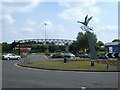

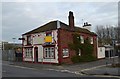

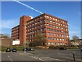
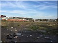


92 photos from this area
Area Information
Key information about the ST1 5NS including its size, population, and administrative classification.
- Area Type
- Postcode
- Area Size
- 3.0 hectares
- Population
- 2394
- Population Density
- 994 people/km²
House Prices in ST1 5NS
6
Properties
-
Average Sold Price
-
Lowest Price
-
Highest Price
Showing 6 properties
| Address | Type | Beds | Baths | Last Sale Price | Last Sale Date | |
|---|---|---|---|---|---|---|
| Living Accommodation, 147 Etruria Road, Stoke On Trent, ST1 5NS | Retail | - | - | - | - | |
| Teasdale Healthcare Limited, Part First And Second Floor, Festival House, 213 Etruria Road, Stoke On Trent, ST1 5NS | Office | - | - | - | - | |
| Nando'slimited, Unit 3, Etruria Mills, Etruria Road, Stoke On Trent, ST1 5NS | restaurant_cafe | - | - | - | - | |
| Tgi Fridays Uk Limited, Unit 2, Etruria Mills, Etruria Road, Stoke On Trent, ST1 5NS | restaurant_cafe | - | - | - | - | |
| Wagamama, Unit 1, Etruria Mills, Etruria Road, Stoke On Trent, ST1 5NS | restaurant_cafe | - | - | - | - | |
| Papa Johns Pizza (sph Foods (hanley) Ltd), 147 Etruria Road, Stoke On Trent, ST1 5NS | Retail | - | - | - | - |
Energy Efficiency in ST1 5NS
Amenities
Schools
| Rank | School | Type | Entry gender | Ages |
|---|
Explore more schools in this area
Go to Schools tabDemographics
Household Size
One person
most common
Accommodation Type
Houses
most common
Tenure
49
majority
Ethnic Group
White
most common
Religion
N/A
most common
Household Composition
N/A
most common
Age
47
median
Adults (30-64 years)
most common
Household Deprivation
N/A
with no deprivation
NS-SEC
18
in Lower managerial occupations
Explore more demographic insights in this area
Go to Demographics tabPlanning
Planning Constraints
- Flood RiskPremium
- Ramsar Wetland SitesPremium
- Area of Outstanding Natural BeautyPremium
- Protected Nature ReservePremium
- Protected WoodlandPremium