Area Overview for ST1 5EN
Photos of ST1 5EN
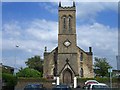
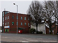
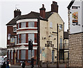
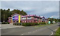
72 photos from this area
Area Information
Key information about the ST1 5EN including its size, population, and administrative classification.
- Area Type
- Postcode
- Area Size
- 7448 m²
- Population
- 1907
- Population Density
- 6748 people/km²
House Prices in ST1 5EN
60
Properties
£58,659
Average Sold Price
£13,000
Lowest Price
£105,000
Highest Price
Showing 60 properties
| Address | Type | Beds | Baths | Last Sale Price | Last Sale Date | |
|---|---|---|---|---|---|---|
| 46 Derwent Street, Cobridge, Stoke On Trent, ST1 5EN | Terraced | 2 | 2 | £62,000 | May 2025 | |
| 57 Derwent Street, Cobridge, Stoke On Trent, ST1 5EN | Terraced | 2 | 1 | £72,000 | Mar 2025 | |
| 26 Derwent Street, Cobridge, Stoke On Trent, ST1 5EN | house | 3 | 1 | £105,000 | Dec 2024 | |
| 54 Derwent Street, Cobridge, Stoke On Trent, ST1 5EN | house | - | - | £70,000 | Nov 2024 | |
| 52 Derwent Street, Cobridge, Stoke On Trent, ST1 5EN | house | - | - | £88,000 | Jul 2024 | |
| 53 Derwent Street, Cobridge, Stoke On Trent, ST1 5EN | Terraced | 2 | 1 | £80,000 | Feb 2024 | |
| 48 Derwent Street, Cobridge, Stoke On Trent, ST1 5EN | Terraced | 2 | 1 | £73,000 | Jun 2023 | |
| 45 Derwent Street, Cobridge, Stoke On Trent, ST1 5EN | Terraced | 2 | 1 | £85,000 | Nov 2022 | |
| 72 Derwent Street, Cobridge, Stoke On Trent, ST1 5EN | Terraced | 2 | 1 | £87,250 | May 2022 | |
| 25 Derwent Street, Cobridge, Stoke On Trent, ST1 5EN | house | - | - | £66,500 | Sep 2021 |
Page 1 of 6
Energy Efficiency in ST1 5EN
Amenities
Schools
| Rank | School | Type | Entry gender | Ages |
|---|
Explore more schools in this area
Go to Schools tabDemographics
Household Size
Family (3-5 people)
most common
Accommodation Type
Houses
most common
Tenure
39
majority
Ethnic Group
White
most common
Religion
N/A
most common
Household Composition
N/A
most common
Age
47
median
Adults (30-64 years)
most common
Household Deprivation
N/A
with no deprivation
NS-SEC
13
in Lower managerial occupations
Explore more demographic insights in this area
Go to Demographics tabPlanning
Planning Constraints
- Flood RiskPremium
- Ramsar Wetland SitesPremium
- Area of Outstanding Natural BeautyPremium
- Protected Nature ReservePremium
- Protected WoodlandPremium