Area Overview for ST1 4DP
Photos of ST1 4DP

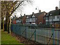
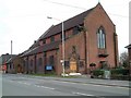
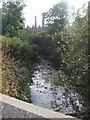
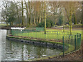

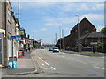
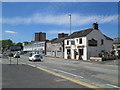
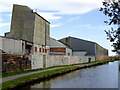


100 photos from this area
Area Information
Key information about the ST1 4DP including its size, population, and administrative classification.
- Area Type
- Postcode
- Area Size
- 2.6 hectares
- Population
- 2131
- Population Density
- 2169 people/km²
House Prices in ST1 4DP
19
Properties
£51,595
Average Sold Price
£14,500
Lowest Price
£83,500
Highest Price
Showing 19 properties
| Address | Type | Beds | Baths | Last Sale Price | Last Sale Date | |
|---|---|---|---|---|---|---|
| 4 Raymond Street, Shelton, Stoke On Trent, ST1 4DP | Semi-detached | 2 | 1 | £83,500 | Feb 2021 | |
| 50 Raymond Street, Shelton, Stoke On Trent, ST1 4DP | Terraced | 2 | 1 | £58,500 | Sep 2016 | |
| 42 Raymond Street, Shelton, Stoke On Trent, ST1 4DP | house | 2 | - | £61,500 | Apr 2011 | |
| 46 Raymond Street, Shelton, Stoke On Trent, ST1 4DP | Terraced | - | - | £64,950 | Jul 2008 | |
| 61 Raymond Street, Shelton, Stoke On Trent, ST1 4DP | Terraced | - | - | £78,000 | Mar 2008 | |
| 57 Raymond Street, Shelton, Stoke On Trent, ST1 4DP | Terraced | - | - | £56,000 | Aug 2004 | |
| 63 Raymond Street, Shelton, Stoke On Trent, ST1 4DP | Detached | - | - | £42,500 | Jul 2004 | |
| 2 Raymond Street, Shelton, Stoke On Trent, ST1 4DP | Industrial | - | - | £14,500 | Nov 2003 | |
| 44 Raymond Street, Shelton, Stoke On Trent, ST1 4DP | Terraced | - | - | £32,000 | Oct 1997 | |
| 52 Raymond Street, Shelton, Stoke On Trent, ST1 4DP | house | - | - | £24,500 | Jul 1995 |
Page 1 of 2
Energy Efficiency in ST1 4DP
Amenities
Schools
| Rank | School | Type | Entry gender | Ages |
|---|
Explore more schools in this area
Go to Schools tabDemographics
Household Size
One person
most common
Accommodation Type
Houses
most common
Tenure
20
majority
Ethnic Group
White
most common
Religion
N/A
most common
Household Composition
N/A
most common
Age
22
median
Adults (30-64 years)
most common
Household Deprivation
N/A
with no deprivation
NS-SEC
12
in Lower managerial occupations
Explore more demographic insights in this area
Go to Demographics tabPlanning
Planning Constraints
- Flood RiskPremium
- Ramsar Wetland SitesPremium
- Area of Outstanding Natural BeautyPremium
- Protected Nature ReservePremium
- Protected WoodlandPremium