Area Overview for ST1 3TH
Photos of ST1 3TH

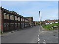

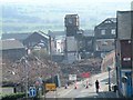


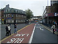


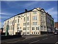

100 photos from this area
Area Information
Key information about the ST1 3TH including its size, population, and administrative classification.
- Area Type
- Postcode
- Area Size
- 5711 m²
- Population
- 1088
- Population Density
- 4912 people/km²
House Prices in ST1 3TH
14
Properties
£132,803
Average Sold Price
£86,000
Lowest Price
£200,000
Highest Price
Showing 14 properties
| Address | Type | Beds | Baths | Last Sale Price | Last Sale Date | |
|---|---|---|---|---|---|---|
| 12 Rosedawn Close East, Hanley, Stoke On Trent, ST1 3TH | Terraced | 2 | 2 | £200,000 | Jul 2025 | |
| 34 Rosedawn Close East, Hanley, Stoke On Trent, ST1 3TH | Flat | 2 | 1 | £120,000 | Nov 2022 | |
| 32 Rosedawn Close East, Hanley, Stoke On Trent, ST1 3TH | Flat | 2 | 1 | £98,000 | Apr 2022 | |
| 25 Rosedawn Close East, Hanley, Stoke On Trent, ST1 3TH | Terraced | 4 | 3 | £193,000 | Dec 2019 | |
| 14 Rosedawn Close East, Hanley, Stoke On Trent, ST1 3TH | house | - | - | £140,000 | Mar 2019 | |
| 26 Rosedawn Close East, Hanley, Stoke On Trent, ST1 3TH | Flat | - | - | £98,500 | Sep 2017 | |
| 18 Rosedawn Close East, Hanley, Stoke On Trent, ST1 3TH | Terraced | 3 | 1 | £125,000 | Oct 2016 | |
| 22 Rosedawn Close East, Hanley, Stoke On Trent, ST1 3TH | house | - | - | £124,950 | Jul 2014 | |
| 24 Rosedawn Close East, Hanley, Stoke On Trent, ST1 3TH | Flat | - | - | £86,000 | Mar 2009 | |
| 16 Rosedawn Close East, Hanley, Stoke On Trent, ST1 3TH | house | - | - | £135,000 | Mar 2009 |
Page 1 of 2
Energy Efficiency in ST1 3TH
Amenities
Schools
| Rank | School | Type | Entry gender | Ages |
|---|
Explore more schools in this area
Go to Schools tabDemographics
Household Size
One person
most common
Accommodation Type
Houses
most common
Tenure
63
majority
Ethnic Group
White
most common
Religion
N/A
most common
Household Composition
N/A
most common
Age
47
median
Adults (30-64 years)
most common
Household Deprivation
N/A
with no deprivation
NS-SEC
33
in Lower managerial occupations
Explore more demographic insights in this area
Go to Demographics tabPlanning
Planning Constraints
- Flood RiskPremium
- Ramsar Wetland SitesPremium
- Area of Outstanding Natural BeautyPremium
- Protected Nature ReservePremium
- Protected WoodlandPremium