Area Overview for St. Michael's & Stonefield Ward
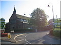
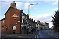
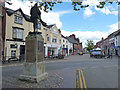
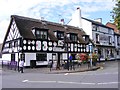
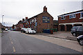
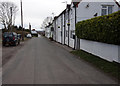
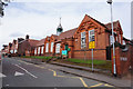
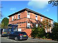
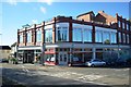
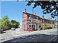
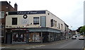
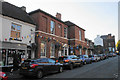
Photos of St. Michael's & Stonefield Ward
Area Information
St. Michael's & Stonefield Ward stands as a distinct district unitary ward within England, covering a compact area of 5.4 square kilometres. This specific locality offers a settled environment defined by its clear boundaries and significant portion of privately owned homes. The character of the ward is rooted in stability, evidenced by the high rate of residents who have chosen to put down roots rather than remain temporary tenants. You find a neighbourhood where long-term habitation is the norm, creating a community focused on residence rather than transience. The physical size allows for manageable daily commutes whilst maintaining a distinct sense of place. Prospective buyers looking at St. Michael's & Stonefield Ward are entering a market dominated by ownership. There are no transitional or temporary housing projects dominating the landscape here. Instead, the architecture and land use reflect a mature settlement where families and individual owners have shaped the local character over many years. The environment is free from major protected nature reserves or wetland sites, which simplifies planning and ensures that development in the ward is not constrained by strict ecological designations often found elsewhere. This makes the area accessible for those who value straightforward property boundaries without the complexity of restricted consents.
- Area Type
- District Borough Unitary Ward
- Area Size
- 5.4 km²
- Population
- Not available
- Population Density
- Not available
Demographics
The community profile of St. Michael's & Stonefield Ward reveals a population skewed heavily towards older age groups. Statistical analysis shows a median age of 70 years, indicating that the majority of local residents are senior citizens. The most common age bracket corresponds to the total age population, confirming that this is a mature demographic area rather than a hub for young professionals or students. Home ownership plays a central role in this demographic structure, with 68% of households fully owning their residences. This high ownership rate aligns perfectly with the older median age, as senior buyers typically accumulate property equity over decades of employment. The overall composition of households and accommodation types reflects this shift, with a lack of data on specific tenure breakdowns suggesting a uniform stock of privately held homes. There is no indication of significant rental turnover or short-term letting within the ward. The demographic data does not provide specific figures for ethnicity or religious affiliation, but the stability of the 68% ownership figure points to a community built on permanent settlement. Families in this ward are likely to include retirees downsizing from larger properties or long-term couples remaining in family-sized estates.
Household Size
Accommodation Type
Tenure
Ethnic Group
Religion
Household Composition
Age
Household Deprivation
NS-SEC
Explore more demographic insights in this area
Go to Demographics tabPlanning
Planning Constraints
- Flood RiskLocked
- Ramsar Wetland SitesLocked
- Area of Outstanding Natural BeautyLocked
- Protected Nature ReserveLocked
- Protected WoodlandLocked
- Crime RiskLocked