Area Overview for SK17 0HB
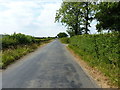
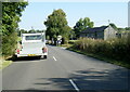
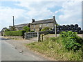
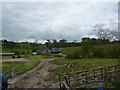
Photos of SK17 0HB


Area Information
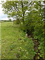
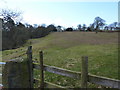
Living in SK17 0HB offers a distinctly quiet residential experience within Staffordshire. This specific postcode cluster covers an area of just 1.1 square kilometres, housing a population of 1,723 people. The result is a very low-density environment with only 20 people per square kilometre. You are located in a small, self-contained residential zone where space is abundant and noise levels remain low. Daily life here revolves around local neighbourhood interactions rather than the rush of a busy town centre, reflecting its nature as a dedicated housing cluster. The area functions as a peaceful retreat, ideal for those seeking a slower pace with ample room to move around. While the immediate surroundings are limited in size, the location provides a stable foundation for family life or retirement. Owners often appreciate the localised feel, where residents know their neighbours and the community remains cohesive. The compact size means fewer amenities are found directly within the immediate streets, but the area itself remains undisturbed day and night. Whether you are looking for a garden home or a spacious plot, the physical layout supports a lifestyle focused on tranquillity and space.
- Area Type
- Postcode
- Area Size
- 1.1 km²
- Population
- 1723
- Population Density
- 20 people/km²
The property market in SK17 0HB is characterised by a predominance of houses. Data confirms that houses are the primary accommodation type available in this postcode. With 76% of households being owner-occupied, the area functions largely as an established residential zone rather than a hub for buy-to-let investors. This high ownership rate typically means properties are sold by current owners who may wish to upgrade or retire, rather than by landlords seeking short-term tenants. You are likely to encounter a market where prices reflect long-term value and local stability. The small size of the area, covering just 1.1 square kilometres, limits the total number of homes for sale at any single moment. Prospective buyers should expect a competitive environment where interest is concentrated on the few available properties. The presence of mostly houses suggests a market geared towards families or downsizers looking for traditional layouts and gardens. Rental data is not explicitly detailed, but the high ownership percentage implies a low proportion of private rentals. When viewing homes in SK17 0HB, you will find a stock dominated by owner-occupier standards rather than student accommodation or transient housing.
House Prices in SK17 0HB
Showing 4 properties
| Address | Type | Beds | Baths | Last Sale Price | Last Sale Date | |
|---|---|---|---|---|---|---|
| Hayes Gate Farm, Hayes Gate Road, Warslow, SK17 0HB | Semi-detached | - | - | - | - | |
| Manor House Farm, Hayes Gate Road, Warslow, SK17 0HB | Detached | - | - | - | - | |
| Lower Hayes Gate Farm, Hayes Gate Road, Warslow, SK17 0HB | house | - | - | - | - | |
| Hollow Farm, Hayes Gate Road, Warslow, SK17 0HB | Detached | 4 | - | - | - |
Energy Efficiency in SK17 0HB
Amenities
Schools
Families living in SK17 0HB have access to several primary schools within the local vicinity. St Bartholomew's CofE (C) School is a primary institution rated as satisfactory by Ofsted. Nearby options include Warslow CofE Middle School, which also operates as a primary school. Manifold Church of England Primary School appears on the list twice due to slight naming variations in records, and it holds a 'good' Ofsted rating. All listed schools are faith-based institutions, specifically Church of England settings, which may influence the decision for religious families. There are no secondary schools or academies listed in the immediate data provided for this specific postcode cluster. This mix means parents must consider transport needs when choosing between St Bartholomew's and Manifold Church of England Primary School. The satisfactory rating for St Bartholomew's indicates the school meets required standards, while the good rating for Manifold suggests a slightly higher performance metric. School catchment areas for these specific institutions should be checked against the exact property address, as the cluster's small size means boundaries can be precise.
| Rank | School | Type | Entry gender | Ages |
|---|
Explore more schools in this area
Go to Schools tabDemographics
The community in SK17 0HB is defined by a mature demographic profile, with a median age of 47 years. Residents falling within the 30 to 64 age range form the most common group, indicating a population driven by families and mid-career professionals. Homeownership is strong, standing at 76% of households, which suggests a stable, settled community rather than a high-turnover rental market. The majority of accommodation consists of houses, aligning with the preferences of residents who value space and ownership. Culturally, the area is predominantly White, with little evidence of other major ethnic groups in the current census snapshot. This demographic mix contributes to a predictable and consistent neighbourhood character. The high level of home ownership implies that many occupants have lived here for years, fostering long-term friendships and local networks. You are buying into an area where stability is the norm. Deprivation metrics are not provided in the available records, so the focus here remains on the clear picture of age and ownership. The population density is exceptionally low, which often correlates with less pressure on public services within the immediate walking distance.
Household Size
Accommodation Type
Tenure
Ethnic Group
Religion
Household Composition
Age
Household Deprivation
NS-SEC
Explore more demographic insights in this area
Go to Demographics tabPlanning
Planning Constraints
- Flood RiskPremium
- Ramsar Wetland SitesPremium
- Area of Outstanding Natural BeautyPremium
- Protected Nature ReservePremium
- Protected WoodlandPremium