Area Overview for SK11 0SJ
Photos of SK11 0SJ
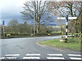
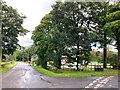
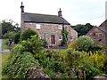
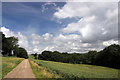
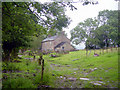
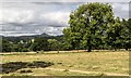
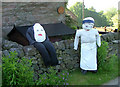
11 photos from this area
Area Information
Key information about the SK11 0SJ including its size, population, and administrative classification.
- Area Type
- Postcode
- Area Size
- 2.1 km²
- Population
- 1592
- Population Density
- 18 people/km²
House Prices in SK11 0SJ
39
Properties
£403,712
Average Sold Price
£110,000
Lowest Price
£840,000
Highest Price
Showing 39 properties
| Address | Type | Beds | Baths | Last Sale Price | Last Sale Date | |
|---|---|---|---|---|---|---|
| Penn Cottage, Heaton Village Road, Heaton, SK11 0SJ | Detached | 3 | 1 | £650,000 | Aug 2024 | |
| Ivy Cottage, Back Lane, Heaton, Rushton Spencer, SK11 0SJ | house | 2 | 1 | £350,000 | Sep 2022 | |
| HAWKSBRIDGE BUNGALOW, RUDYARD ROAD, Heaton, SK11 0SJ | Bungalow | - | - | £500,000 | May 2022 | |
| Gun End Farm, Rudyard Old Road, Rudyard, SK11 0SJ | Retail | 2 | 1 | £475,000 | Apr 2022 | |
| The Smithy, Heaton Village Road, Heaton, SK11 0SJ | Detached | 2 | - | £340,000 | Dec 2021 | |
| Woodlands, Bearda Hill, Swythamley, Rushton Spencer, SK11 0SJ | house | - | - | £325,000 | Jun 2021 | |
| Camel Tree Cottage, Bearda Hill, Swythamley, Rushton Spencer, SK11 0SJ | house | - | - | £139,250 | Jun 2021 | |
| Bent End Farm, Bearda Hill, Swythamley, Rushton Spencer, SK11 0SJ | Farm | 4 | 3 | £840,000 | Sep 2019 | |
| Heaton Bank, Back Lane, Heaton, Rushton Spencer, SK11 0SJ | Cottage | 2 | - | £575,000 | Dec 2017 | |
| Gun End Barn, Rudyard Old Road, Rudyard, SK11 0SJ | Semi-detached | 3 | - | £520,000 | Jul 2016 |
Page 1 of 4
Energy Efficiency in SK11 0SJ
Amenities
Schools
| Rank | School | Type | Entry gender | Ages |
|---|
Explore more schools in this area
Go to Schools tabDemographics
Household Size
Two person
most common
Accommodation Type
Houses
most common
Tenure
81
majority
Ethnic Group
White
most common
Religion
N/A
most common
Household Composition
N/A
most common
Age
47
median
Adults (30-64 years)
most common
Household Deprivation
N/A
with no deprivation
NS-SEC
35
in Lower managerial occupations
Explore more demographic insights in this area
Go to Demographics tabPlanning
Planning Constraints
- Flood RiskPremium
- Ramsar Wetland SitesPremium
- Area of Outstanding Natural BeautyPremium
- Protected Nature ReservePremium
- Protected WoodlandPremium