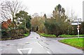
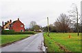
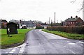
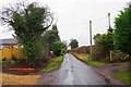
Area Overview for Sinton Green
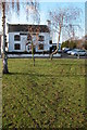
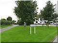
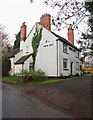
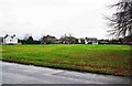
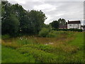
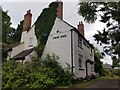
Photos of Sinton Green


Area Information
Sinton Green is a compact built-up area in England, covering 21.2 hectares. It is a place where older residents predominate, with a median age of 70, reflecting a community shaped by long-term settlement. The area’s size suggests a tight-knit, low-density environment, where daily life is likely centred around local shops and transport links. With 77% of homes owner-occupied, the area has a stable housing stock, though the types of properties are not specified. Proximity to three railway stations—Worcester Foregate Street, Worcester Shrub Hill, and Droitwich Spa—offers easy access to nearby towns, while nearby supermarkets such as Co-op Claines and Lidl Droitwich provide essential retail. Living here means balancing a quieter, older demographic with practical connectivity. The area’s character is defined by its modest scale, established infrastructure, and the presence of retail and transport hubs within reach. For buyers, it may appeal to those seeking a settled, low-maintenance lifestyle with reliable access to services.
- Area Type
- Built Up Area 250
- Area Size
- 21.2 hectares
- Population
- Not available
- Population Density
- Not available
Daily life in Sinton Green is supported by nearby retail options, including Co-op Claines, Lidl Droitwich, and Co-op Ombersley, which provide groceries and essentials. These shops are likely to be within walking or short driving distance, offering convenience for residents. The area’s railway stations connect to broader networks, enabling access to cultural, professional, or leisure opportunities in nearby towns. While the data does not mention parks or recreational spaces, the presence of retail and transport hubs suggests a practical, service-oriented lifestyle. The character of the area is defined by its accessibility and the availability of basic amenities, though the absence of specific details on leisure facilities means buyers should investigate further for recreational options.
Amenities
Schools
| Rank | A + A* % | School | Type | Entry gender | Ages |
|---|
Explore more schools in this area
Go to Schools tabDemographics
Sinton Green’s population is predominantly older, with a median age of 70, which is significantly higher than the national average. This suggests a community where retirement is the primary life stage, though the data does not specify whether this is due to migration patterns or local demographics. Home ownership is high at 77%, indicating a stable, long-term resident base. The data does not provide details on household composition or ethnic diversity, but the absence of specific figures implies a lack of significant variation in these areas. The area’s age profile may influence local services and amenities, with a focus on healthcare and leisure suited to older adults. While the data does not quantify deprivation levels, the high home ownership and low crime risk suggest a relatively stable quality of life for residents.
Household Size
Accommodation Type
Tenure
Ethnic Group
Religion
Household Composition
Age
Household Deprivation
NS-SEC
Explore more demographic insights in this area
Go to Demographics tabPlanning
Planning Constraints
- Crime RiskLocked