Area Overview for Shobnall
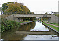
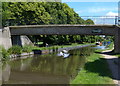
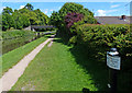
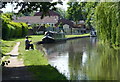
Photos of Shobnall


Area Information
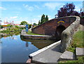
Living in Shobnall means residing within a small civil parish covering just 3.0 square kilometres. This compact footprint defines the pace of daily life, where distances between your home, local amenities, and neighbours remain short. The area operates under a rural housing designation, meaning the built environment is constrained and integrated closely with the surrounding landscape. You do not deal with large-scale urban sprawl here; instead, your home exists within a defined, intimate community boundary. This specific layout ensures that the character of the parish remains consistent, avoiding the fragmentation common in larger settlements. The small total area supports a tight-knit environment where the distance to key services is negligible. While the population figures for the post-code area represent the total household composition, the physical scale dictates a quieter existence compared to broader districts. Prospective buyers often seek this level of containment for those wishing to avoid the chaos of major cities or sprawling villages. The lack of additional descriptors in the official data suggests the area retains a traditional profile without the glossy gloss of commercial development. Shobnall offers a straightforward proposition for homebuyers who prioritise physical boundaries over expansive urban infrastructure. Your morning commute and evening stroll both occur within a clearly defined geographic zone.
- Area Type
- District Borough Unitary Ward
- Area Size
- 3.0 km²
- Population
- Not available
- Population Density
- Not available
Demographics
The community profile of Shobnall reflects an older generation with significant implications for local dynamics. The median age of residents stands at exactly 70 years, positioning this parish as a retirement destination rather than a hub for young families or professionals. Most households consist of older occupants, which typically defines the social interactions, pace of life, and service requirements within the area. This age skew influences the types of amenities that remain relevant, from healthcare access to quieter public spaces. Home ownership accounts for 46% of the housing stock, indicating that nearly half of the residents are tenants rather than owners. The household composition data confirms that the total population structure aligns with the older resident demographic. Deprivation data is not part of the provided information for this specific area, so any assessment of economic standing must rely on external knowledge not present in these records. You can expect interactions primarily with peers in the same age bracket, creating a subdued social atmosphere. The total accommodation type data shows no variance, suggesting a uniformity in housing usage patterns across the parish. This demographic reality means schools or youth-focused activities may see reduced attendance compared to more balanced villages. Living here requires an appreciation for the specific needs of a predominantly senior population.
Household Size
Accommodation Type
Tenure
Ethnic Group
Religion
Household Composition
Age
Household Deprivation
NS-SEC
Explore more demographic insights in this area
Go to Demographics tabPlanning
Planning Constraints
- Flood RiskPremium
- Ramsar Wetland SitesPremium
- Area of Outstanding Natural BeautyPremium
- Protected Nature ReservePremium
- Protected WoodlandPremium
- Crime RiskPremium