Area Overview for Shirley West Ward
Photos of Shirley West Ward
Area Information
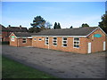
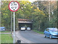
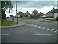
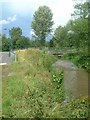
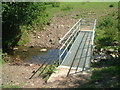
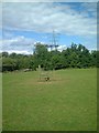
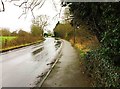
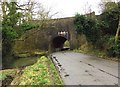
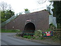
Shirley West Ward forms part of the residential suburb of Shirley within the Metropolitan Borough of Solihull. You will find this urban electoral ward situated approximately 3 miles southeast of Solihull town centre, lying along the Stratford Road. The area covers 2.7 km², offering a compact neighbourhood bordered by Yardley Wood to the north and Bromsgrove to the south. Historically, this location dates back to around 1240 as 'Syrlie', meaning a bright clearing in Old English. Previously part of the Manor of Ulverlei, it joined Solihull parish in the late 12th century. The region features significant historical landmarks, including St James' Church, built in 1832, and the Berry Mound Iron Age Hill Fort site. A former racecourse now known as Shirley Golf Club sits within the neighbourhood, reflecting the area's evolution from a farm settlement to a prominent suburban district. Princess Margaret presented the borough charter at the local Odeon Cinema in 1954, marking a key moment in local development. Living in Shirley West Ward means residing in a community that blends historical depth with modern suburban conveniences. The proximity to Junction 4 of the M42 motorway provides direct access to Birmingham and Stratford-upon-Avon, highlighting its strategic location within the West Midlands landscape.
- Area Type
- District Borough Unitary Ward
- Area Size
- 2.7 km²
- Population
- Not available
- Population Density
- Not available
Demographics
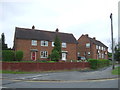
The community profile of Shirley West Ward reflects an established and mature neighbourhood. Residents here have a median age of 70, indicating a population skewed significantly towards older occupants. Home ownership stands at a rate of 77%, establishing the area as a stronghold for those who have purchased residences rather than renters. This high level of ownership suggests long-term residency and financial stability among householders. You will find that the ward consists primarily of owner-occupied homes, a fact confirmed by the 77% statistic present in local records. The area lacks significant deprivation compared to some neighbouring wards in south Solihull, specifically contrasting with areas like Solihull Lodge and Shirley Park. There is no recorded data regarding specific household composition breakdowns, predominant ethnic groups, or religious affiliations within the provided information. However, the age profile clearly paints a picture of a quieter, settled community. Those considering living in Shirley West Ward should note that the demographic makeup is distinct from younger, transient urban centres. The high ownership rate coupled with the older median age creates an environment where neighbours likely live in proximity for decades, fostering deep local roots and stability within the streets of this 2.7 km² district.
Household Size
Accommodation Type
Tenure
Ethnic Group
Religion
Household Composition
Age
Household Deprivation
NS-SEC
Explore more demographic insights in this area
Go to Demographics tabPlanning
Planning Constraints
- Flood RiskPremium
- Ramsar Wetland SitesPremium
- Area of Outstanding Natural BeautyPremium
- Protected Nature ReservePremium
- Protected WoodlandPremium
- Crime RiskPremium