Area Overview for Sedgley
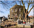
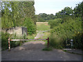
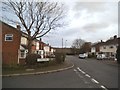
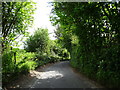
Photos of Sedgley


Area Information
Sedgley, a compact built-up area in England, spans 7.3 km² and is home to 1,380 residents, giving it a population density of 188 people per square kilometre. This small but defined community offers a quiet, low-density living environment, with a median age of 70 suggesting a predominantly older demographic. The area’s modest size means residents are likely within easy reach of local amenities, shops, and transport links. Sedgley’s character is shaped by its proximity to nearby towns and cities, offering a balance between rural tranquillity and urban accessibility. With 72% of homes owned by residents, the area reflects a stable, long-term community rather than a transient rental market. Daily life here is likely to be unhurried, with a focus on local connections and practical living. The presence of multiple schools, rail stations, and retail outlets within practical reach ensures that essential needs are met without the need for long commutes. For those seeking a peaceful, well-connected home, Sedgley’s blend of small-town charm and modern convenience is worth considering.
- Area Type
- Built Up Area 250
- Area Size
- 7.3 km²
- Population
- 1380
- Population Density
- 188 people/km²
Sedgley’s residents have access to a range of practical amenities within easy reach. The area includes five retail outlets, such as Tesco Gornal, Asda Sedgley, and Iceland Sedgley, ensuring everyday shopping needs are met. Nearby rail and metro stations—Coseley, Tipton, Dudley Port, Priestfield, Crescent, and Bilston Central—provide convenient links to surrounding towns and cities. The Wolverhampton Halfpenny Green Airport, though not a major international hub, offers additional travel options. While specific parks or leisure facilities are not listed, the density of retail and transport options suggests a focus on practicality over expansive recreational spaces. For families, the proximity of multiple schools and shops creates a self-contained environment, reducing the need for lengthy trips. The area’s amenities support a lifestyle that prioritises convenience and connectivity.
Amenities
Schools
Sedgley is served by several primary schools, including Red Hall Primary School and Cotwall End Primary School, both of which have Ofsted ratings of “Good.” Red Hall Infant School also provides early education, though its rating is not specified. Roberts Primary School has an Ofsted rating of “Satisfactory,” while Queen Victoria Primary School is listed without a rating. The presence of multiple primary schools within the area ensures that families have options, though the varying ratings highlight differences in educational quality. Parents may wish to visit schools directly to assess their suitability. For those prioritising high-performing schools, Red Hall and Cotwall End offer reassuringly strong evaluations. The mix of school types and ratings means families can choose between established institutions and newer or smaller schools.
| Rank | School | Type | Entry gender | Ages |
|---|
Explore more schools in this area
Go to Schools tabDemographics
Sedgley’s population has a median age of 70, indicating a community skewed towards older residents. The most common age range is listed as “Total,” which suggests aggregated data rather than specific age brackets. Home ownership is high at 72%, reflecting a stable population with long-term residency. This figure implies that many residents are likely to have lived in the area for years, contributing to a sense of continuity. The data does not specify household composition or accommodation types, but the high home ownership rate suggests a mix of family homes and single-occupancy properties. The absence of detailed diversity metrics means the area’s ethnic or cultural composition remains undefined. For quality of life, the low population density and high home ownership may support a quieter, more cohesive community, though further data would be needed to assess deprivation levels or social dynamics.
Household Size
Accommodation Type
Tenure
Ethnic Group
Religion
Household Composition
Age
Household Deprivation
NS-SEC
Explore more demographic insights in this area
Go to Demographics tabPlanning
Planning Constraints
- Crime RiskPremium