Area Overview for Ruyton-XI-Towns
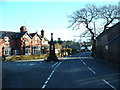
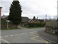
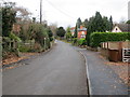
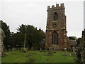
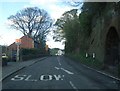
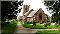
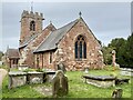
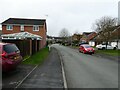
Photos of Ruyton-XI-Towns

Area Information
Ruyton-XI-Towns is a compact built-up area in England, spanning 65.4 hectares. It is a place shaped by its demographic profile, with a median age of 70, suggesting a community skewed towards older residents. This area is not defined by sprawling development but by a focused, residential character. Daily life here is likely to revolve around local amenities and proximity to essential services. The presence of two schools—St John the Baptist CofE Primary and Packwood Haugh—hints at a mix of state and independent education options, catering to different family needs. For those considering living in Ruyton-XI-Towns, the blend of modest area size and accessible infrastructure may appeal to those seeking a quieter, community-oriented environment. The nearby Spar and Co-op Bomere provide basic retail convenience, while Sleap Airport offers a practical transport link for regional travel. This area is not for those seeking a fast-paced urban lifestyle but suits those prioritising safety, simplicity, and proximity to essential services.
- Area Type
- Built Up Area 250
- Area Size
- 65.4 hectares
- Population
- Not available
- Population Density
- Not available
The lifestyle in Ruyton-XI-Towns is shaped by its nearby amenities, which include two retail outlets—Spar and Co-op Bomere—offering essential goods and services. These stores provide convenience for daily errands, though the lack of additional retail or leisure venues suggests a modest retail landscape. The presence of Sleap Airport, while not detailed in terms of flight frequency, offers a practical link to regional travel. For residents, the area’s character is defined by its simplicity and focus on basic needs. There is no mention of parks or recreational spaces in the data, so leisure options may be limited to nearby natural areas or community facilities not specified here. The combination of retail access and transport links creates a functional, if unadorned, daily life for residents.
Amenities
Schools
Ruyton-XI-Towns is served by two schools: St John the Baptist CofE (Controlled) Primary School and Nursery, which has an Ofsted rating of ‘good’, and Packwood Haugh School, an independent institution. The presence of both state and independent options provides families with choices, whether they prioritise affordability or specialised education. The primary school’s ‘good’ rating suggests a reliable foundation for early education, while the independent school may cater to those seeking alternative curricula or smaller class sizes. For families with children, this mix of school types could be a key consideration, offering flexibility depending on educational preferences and budget. The proximity of these schools to the area underscores their role in shaping the local community’s character.
| Rank | A + A* % | School | Type | Entry gender | Ages |
|---|---|---|---|---|---|
| 1 | N/A | St John the Baptist CofE (Controlled) Primary School and Nursery | primary | N/A | N/A |
| 2 | N/A | Packwood Haugh School | independent | N/A | N/A |
Explore more schools in this area
Go to Schools tabDemographics
The population of Ruyton-XI-Towns has a median age of 70, indicating a community predominantly composed of older individuals. This age profile suggests a demographic where retirement and long-term residency are common. Home ownership is high, with 76% of residents owning their homes, reflecting a stable, settled population. The data does not specify household composition or accommodation types, but the overall figures imply a community where property is largely held by long-term residents. There is no information on ethnic diversity or religious composition, so these aspects cannot be detailed. The high home ownership rate and older age profile suggest a low turnover of residents, contributing to a cohesive, familiar local environment. For those considering moving here, this demographic profile may indicate a neighbourhood with established social networks and a slower pace of change.
Household Size
Accommodation Type
Tenure
Ethnic Group
Religion
Household Composition
Age
Household Deprivation
NS-SEC
Explore more demographic insights in this area
Go to Demographics tabPlanning
Planning Constraints
- Crime RiskLocked