Area Overview for Rock Hill Ward
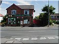
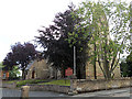
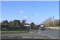
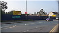
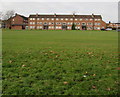
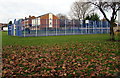
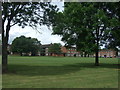
Photos of Rock Hill Ward
Area Information
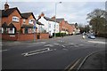
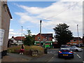
Living in Rock Hill Ward offers a specific type of residential experience defined by its compact scale and mature character. This district borough unitary ward covers an area of just 61.2 hectares, meaning the physical footprint is relatively small. Such a limited size often means that daily travel distances are short, whether you are commuting to work or visiting local shops. The area provides a settled environment where the built-up space is dense and defined. You will find that the neighbourhood is tightly knit, with a consistent architectural style reflecting its history. Prospective buyers looking at homes in Rock Hill Ward should note that the community has evolved into a distinct demographic profile. The area serves as a self-contained ward within the broader local authority structure. Its status as a unitary ward indicates it operates under specific governance arrangements that affect local planning and council services. The small geographical size suggests a high degree of accessibility between properties, which is a practical benefit for those who walk or cycle. However, the compact nature also means there is limited room for large-scale development projects. Residents here likely value the proximity of essential services within a confined boundary.
- Area Type
- District Borough Unitary Ward
- Area Size
- 61.2 hectares
- Population
- Not available
- Population Density
- Not available
Demographics
The community in Rock Hill Ward is defined by a notably mature population. The median age stands at 70 years, which places the average resident significantly older than the national average. This age profile suggests the area attracts retirees or those seeking a quiet lifestyle during retirement years. When you visit Rock Hill Ward, you will encounter a demographic dominated by senior citizens who have likely lived in the area for many years. This stability often translates into a predictable and peaceful neighbourhood atmosphere. Home ownership remains a significant factor in daily life here, with 46% of residents owning their properties outright or with a mortgage. This figure is slightly below the typical ratio found in many affluent retirement destinations, indicating a mixed market. The household composition reflects the presence of long-term residents rather than a transient population of young families. Given the average age, you will find fewer children playing in the streets compared to other family-oriented zones. The demographic data points to a community where longevity and established social networks are the norm. Accommodation types in Rock Hill Ward align with these housing needs, offering stock suitable for older occupancy patterns. While specific breakdowns of bungalows versus standard houses are not available, the overall market density supports a steady housing stock. The area does not appear to pivot towards student housing or young professional apartments. Instead, the dwelling inventory caters to those who prioritise low-maintenance living over urban density. Understanding these demographics helps you assess whether Rock Hill Ward matches your long-term lifestyle requirements.
Household Size
Accommodation Type
Tenure
Ethnic Group
Religion
Household Composition
Age
Household Deprivation
NS-SEC
Explore more demographic insights in this area
Go to Demographics tabPlanning
Planning Constraints
- Flood RiskPremium
- Ramsar Wetland SitesPremium
- Area of Outstanding Natural BeautyPremium
- Protected Nature ReservePremium
- Protected WoodlandPremium
- Crime RiskPremium