Area Overview for OX7 5QB
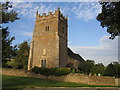
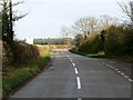
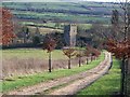
Photos of OX7 5QB


![Re-arranged footpath [2] in OX7 5QB](https://images.propbar.co.uk/images/geograph/16/21/1621469_120.jpg)

![Crossroads [1] in OX7 5QB](https://images.propbar.co.uk/images/geograph/19/29/1929093_120.jpg)
![Crossroads [2] in OX7 5QB](https://images.propbar.co.uk/images/geograph/19/29/1929095_120.jpg)
![Crossroads [3] in OX7 5QB](https://images.propbar.co.uk/images/geograph/19/29/1929099_120.jpg)
Area Information
Living in OX7 5QB means residing in Long Compton, a village and civil parish situated at the southern tip of Warwickshire near the Oxfordshire border. This linear settlement spreads across an area of 1.4 square kilometres, hosting a population of 2,220 people. The community is defined by its historic character, centring on the 13th-century Church of St Peter and St Paul. Earthworks here betray past Saxon settlement, while the Neolithic Rollright Stones lie just a mile away. The village retains an ancient feel, marked by a conservation area and key landmarks such as Weston Park and a restored 17th-century thatched lichgate. Residents enjoy a rural Cotswold setting without the isolation often found in the wider countryside. A practical road network, including the A3400, connects the location to Oxford and Stratford-upon-Avon. Daily life balances village heritage with modern convenience, offering a distinct lifestyle for those who value a linear village layout enhanced by significant historical sites and proximity to natural features.
- Area Type
- Postcode
- Area Size
- 1.4 km²
- Population
- 2220
- Population Density
- 41 people/km²
The property market in OX7 5QB is characterised by a significant majority of owner-occupied homes. Specifically, 74% of households own their residences, indicating a stable market where families have established long-term roots in the area. The remaining 26% of housing stock represents the rental sector, though the dominance of owner-occupiers suggests higher thresholds for entry and purchase. This area predominantly features houses, which is typical for a village of its size within the Cotswolds. Buyers looking for homes in OX7 5QB should expect traditional detached or semi-detached properties suited to family life. The linear nature of the village often means properties are arranged along key roads, with privacy varying by specific location. Because owner-occupiers make up the vast majority of residents, the market may see fewer short-term rentals and a focus on family-sized dwellings. Prospective buyers might find inventory limited compared to larger towns, requiring patience to locate a suitable home that matches their budget and requirements within this cluster.
House Prices in OX7 5QB
Showing 6 properties
| Address | Type | Beds | Baths | Last Sale Price | Last Sale Date | |
|---|---|---|---|---|---|---|
| Saffron House, Rollright Road, Little Rollright, OX7 5QB | house | - | - | £600,810 | Feb 2017 | |
| Saffron Heights, Rollright Road, Little Rollright, OX7 5QB | Detached | - | - | - | - | |
| Toll House, Rollright Road, Little Rollright, OX7 5QB | Detached | - | - | - | - | |
| The Annexe, King Stone Farm, Rollright Road, Little Rollright, OX7 5QB | Bungalow | - | - | - | - | |
| King Stone Farm Stable, Rollright Road, Little Rollright, OX7 5QB | Detached | - | - | - | - | |
| Caravan At, King Stone Farm, Rollright Road, Little Rollright, OX7 5QB | Mobile Home | - | - | - | - |
Energy Efficiency in OX7 5QB
Daily life in OX7 5QB centres around a selection of nearby amenities that serve the local population effectively. For shoppers, residents have choices at Aldi Chipping, Sainsburys Chipping, and Waitrose Little, which are within practical reach for weekly groceries and household items. Dining and socialising can be found in central villages nearby, complemented by the historic Red Lion Inn mentioned in the local history. Transport options include two accessible railway stations at Moreton and Kingham, which connect the area to wider transport networks. The village itself features notable landmarks such as the Church of St Peter and St Paul and the Conservation Area, offering walking routes rich in history. Naturalists might enjoy exploring the Walkers to Rollright Stones path or visiting Weston Park. While the village is self-contained for essentials, shoppers for larger range or specialist items often travel to Chipping Norton or Stratford-upon-Avon. This blend of village convenience and accessible transport creates a balanced lifestyle for those who value a slower pace with easy access to goods.
Amenities
Schools
Families in OX7 5QB have access to local education through Long Compton Junior and Infant School, which serves as a primary institution for the village. The village-level provision ensures children can remain close to home while progressing through their early and middle years. Residents often look further afield for secondary education, though no secondary schools were listed in the immediate vicinity. Long Compton Junior and Infant School provides a local option for young learners within the parish. For broader choices, parents in the OX7 5QB postcodes typically consider schools in Chipping Norton or Stratford-upon-Avon. The presence of only primary-level options locally means that older children will likely travel for secondary education. This setup is common in rural villages where specialist provision is concentrated in larger urban centres. Families must plan travel routes carefully, balancing the desire for local schooling with the availability of secondary options that match their child's needs and preferences.
| Rank | School | Type | Entry gender | Ages |
|---|
Explore more schools in this area
Go to Schools tabDemographics
The community in OX7 5QB reflects an established settlement with a mature population. The median age sits at 47 years, confirming the area as predominantly home to adults aged between 30 and 64. Most residents are long-term family members rather than transient workers or students. Home ownership is the standard living arrangement, with 74% of households owning their property outright or with a mortgage. The remaining 26% likely rely on the rental sector. Accommodation primarily consists of houses, aligning with the village's development of detached and semi-detached properties rather than the high-density blocks found near city centres. This ownership model creates financial stability and a vested interest in the neighbourhood. The predominant ethnic group is White, mirroring the traditional demographic pattern of many rural Warwickshire villages. This statistical profile suggests a stable, family-oriented community where residents are deeply embedded in local life rather than constantly moving in and out.
Household Size
Accommodation Type
Tenure
Ethnic Group
Religion
Household Composition
Age
Household Deprivation
NS-SEC
Explore more demographic insights in this area
Go to Demographics tabPlanning
Planning Constraints
- Flood RiskPremium
- Ramsar Wetland SitesPremium
- Area of Outstanding Natural BeautyPremium
- Protected Nature ReservePremium
- Protected WoodlandPremium