Area Overview for OX17 1HU
Photos of OX17 1HU
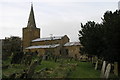
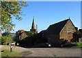
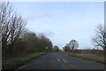
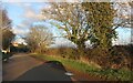

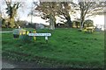
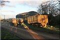
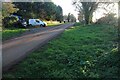

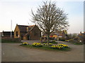

18 photos from this area
Area Information
Key information about the OX17 1HU including its size, population, and administrative classification.
- Area Type
- Postcode
- Area Size
- 35.1 hectares
- Population
- 2338
- Population Density
- 52 people/km²
House Prices in OX17 1HU
15
Properties
£293,813
Average Sold Price
£94,000
Lowest Price
£860,000
Highest Price
Showing 15 properties
| Address | Type | Beds | Baths | Last Sale Price | Last Sale Date | |
|---|---|---|---|---|---|---|
| Suncroft, Mollington Road, Shotteswell, OX17 1HU | Detached | 3 | 1 | £450,000 | Jan 2020 | |
| Gunn Cottage, Main Road, Shotteswell, OX17 1HU | house | - | - | £305,000 | Mar 2016 | |
| Inglewood, Main Road, Shotteswell, OX17 1HU | Detached | 2 | 2 | £193,500 | Mar 2003 | |
| The Manor, Mollington Road, Shotteswell, OX17 1HU | Detached | - | - | £860,000 | May 2002 | |
| New Cottage, Main Road, Shotteswell, OX17 1HU | Cottage | 2 | 1 | £123,500 | Jun 2000 | |
| Red Roof Cottage, Main Road, Shotteswell, OX17 1HU | house | 3 | - | £94,000 | Dec 1997 | |
| Manor Barn, Mollington Road, Shotteswell, OX17 1HU | Detached | 4 | - | £170,000 | Jun 1996 | |
| Oakdene, Mollington Road, Shotteswell, OX17 1HU | Detached | - | - | £154,500 | Sep 1995 | |
| Squirrel Cottage, Mollington Road, Shotteswell, OX17 1HU | Detached | 3 | 1 | - | - | |
| Enchanted Cottage, Mollington Road, Shotteswell, OX17 1HU | house | 1 | 1 | - | - |
Page 1 of 2
Energy Efficiency in OX17 1HU
Amenities
Schools
| Rank | School | Type | Entry gender | Ages |
|---|
Explore more schools in this area
Go to Schools tabDemographics
Household Size
Two person
most common
Accommodation Type
Houses
most common
Tenure
69
majority
Ethnic Group
White
most common
Religion
N/A
most common
Household Composition
N/A
most common
Age
47
median
Adults (30-64 years)
most common
Household Deprivation
N/A
with no deprivation
NS-SEC
46
in Lower managerial occupations
Explore more demographic insights in this area
Go to Demographics tabPlanning
Planning Constraints
- Flood RiskPremium
- Ramsar Wetland SitesPremium
- Area of Outstanding Natural BeautyPremium
- Protected Nature ReservePremium
- Protected WoodlandPremium