Area Overview for OX17 1BU
Photos of OX17 1BU
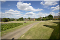

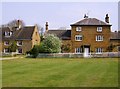
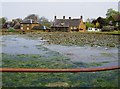
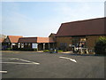
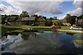
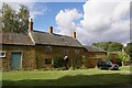
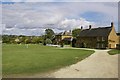
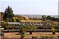
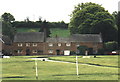
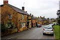
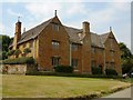
37 photos from this area
Area Information
Key information about the OX17 1BU including its size, population, and administrative classification.
- Area Type
- Postcode
- Area Size
- 5.7 hectares
- Population
- 2338
- Population Density
- 52 people/km²
House Prices in OX17 1BU
31
Properties
£632,750
Average Sold Price
£300,000
Lowest Price
£1,300,000
Highest Price
Showing 31 properties
| Address | Type | Beds | Baths | Last Sale Price | Last Sale Date | |
|---|---|---|---|---|---|---|
| Westering, The Green, Warmington, OX17 1BU | Detached | 6 | 4 | £1,300,000 | Feb 2024 | |
| Bachelors Cottage, Mollington Lane, Warmington, OX17 1BU | Semi-detached | 2 | 2 | £385,000 | Jul 2023 | |
| The Cottage On The Green, The Green, Warmington, OX17 1BU | Semi-detached | 3 | 1 | £345,000 | Feb 2021 | |
| The Court House, The Green, Warmington, OX17 1BU | house | - | - | £300,000 | Jul 2019 | |
| Agdon House, The Green, Warmington, OX17 1BU | Detached | - | - | £1,226,500 | Aug 2015 | |
| Greenways, The Green, Warmington, OX17 1BU | Detached | - | - | £750,000 | Aug 2015 | |
| Fir Tree House, The Green, Warmington, OX17 1BU | house | - | - | £628,500 | Jan 2015 | |
| Gourdon, The Green, Warmington, OX17 1BU | Terraced | - | - | £405,250 | Nov 2003 | |
| Yew Tree Cottage, The Green, Warmington, OX17 1BU | Detached | - | - | £320,000 | Oct 2003 | |
| Harbages Farmhouse, The Green, Warmington, OX17 1BU | Detached | 5 | 3 | £735,000 | Mar 2003 |
Page 1 of 4
Energy Efficiency in OX17 1BU
Amenities
Schools
| Rank | School | Type | Entry gender | Ages |
|---|
Explore more schools in this area
Go to Schools tabDemographics
Household Size
Two person
most common
Accommodation Type
Houses
most common
Tenure
69
majority
Ethnic Group
White
most common
Religion
N/A
most common
Household Composition
N/A
most common
Age
47
median
Adults (30-64 years)
most common
Household Deprivation
N/A
with no deprivation
NS-SEC
46
in Lower managerial occupations
Explore more demographic insights in this area
Go to Demographics tabPlanning
Planning Constraints
- Flood RiskPremium
- Ramsar Wetland SitesPremium
- Area of Outstanding Natural BeautyPremium
- Protected Nature ReservePremium
- Protected WoodlandPremium