Area Overview for OX15 6DS
Photos of OX15 6DS
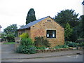
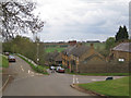
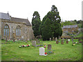
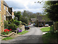
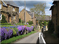
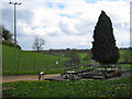
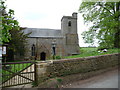
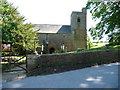
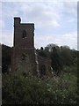
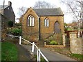
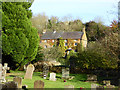
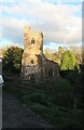
49 photos from this area
Area Information
Key information about the OX15 6DS including its size, population, and administrative classification.
- Area Type
- Postcode
- Area Size
- 1.0 km²
- Population
- 2338
- Population Density
- 52 people/km²
House Prices in OX15 6DS
40
Properties
£496,143
Average Sold Price
£90,000
Lowest Price
£1,030,000
Highest Price
Showing 40 properties
| Address | Type | Beds | Baths | Last Sale Price | Last Sale Date | |
|---|---|---|---|---|---|---|
| Hilltop House, Village Road, Ratley, OX15 6DS | Detached | 5 | 3 | £1,030,000 | Dec 2025 | |
| Hill View, Chapel Lane, Ratley, OX15 6DS | Detached | 5 | 2 | £516,000 | Jun 2024 | |
| The Old School, Village Road, Ratley, OX15 6DS | house | 4 | - | £825,000 | Jul 2022 | |
| Jasmine Cottage, Featherbow Lane, Ratley, OX15 6DS | Semi-detached | 2 | 1 | £340,000 | Nov 2021 | |
| The Old Post Office, Church Street, Ratley, OX15 6DS | house | - | - | £775,000 | Sep 2021 | |
| Greenbanks, Chapel Lane, Ratley, OX15 6DS | Bungalow | 3 | - | £660,000 | Apr 2016 | |
| Woodside, High Street, Ratley, OX15 6DS | Detached | - | - | £325,000 | Feb 2014 | |
| Chapel House, Chapel Lane, Ratley, OX15 6DS | house | 6 | - | £950,000 | Dec 2011 | |
| Holly Cottage, 4 Chapel Lane, Ratley, OX15 6DS | Cottage | 2 | - | £210,000 | Dec 2011 | |
| Larch Bank, High Street, Ratley, OX15 6DS | house | - | - | £395,000 | Jul 2011 |
Page 1 of 4
Energy Efficiency in OX15 6DS
Amenities
Schools
| Rank | School | Type | Entry gender | Ages |
|---|
Explore more schools in this area
Go to Schools tabDemographics
Household Size
Two person
most common
Accommodation Type
Houses
most common
Tenure
69
majority
Ethnic Group
White
most common
Religion
N/A
most common
Household Composition
N/A
most common
Age
47
median
Adults (30-64 years)
most common
Household Deprivation
N/A
with no deprivation
NS-SEC
46
in Lower managerial occupations
Explore more demographic insights in this area
Go to Demographics tabPlanning
Planning Constraints
- Flood RiskPremium
- Ramsar Wetland SitesPremium
- Area of Outstanding Natural BeautyPremium
- Protected Nature ReservePremium
- Protected WoodlandPremium