Area Overview for Oswestry
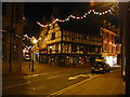
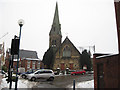
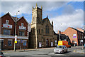
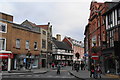
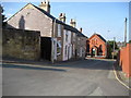
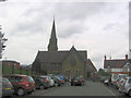
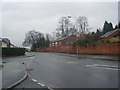
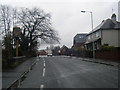
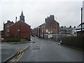
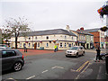
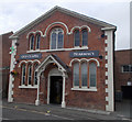
Photos of Oswestry

Area Information
Oswestry is a compact, well-defined built-up area in England, covering 6.0 km² and home to 4,043 residents. Its population density of 678 people per square kilometre suggests a tightly knit community, typical of a small town. The area’s character is shaped by its proximity to nearby railway stations, such as Gobowen and Chirk, which link it to broader regional networks. Daily life here is influenced by its demographic profile, with a median age of 70, indicating a predominantly older population. Residents benefit from a range of local amenities, including five retail outlets like Co-op Oswestry, Lidl, and Sainsburys, ensuring practical access to essentials. The presence of multiple primary schools, including The Meadows Primary School (Ofsted rated 'good') and Our Lady and St Oswald’s Catholic Primary School, underscores the area’s appeal for families. Digital connectivity is strong, with a broadband score of 92 and mobile coverage of 80, supporting both home and work needs. Oswestry offers a blend of practicality and community, making it a viable choice for those seeking a quieter, established living environment with accessible services.
- Area Type
- Built Up Area 250
- Area Size
- 6.0 km²
- Population
- 4043
- Population Density
- 678 people/km²
Oswestry’s lifestyle is shaped by its proximity to essential amenities and a modest range of retail options. The area includes five notable retail outlets, such as Co-op Oswestry, Lidl, and Sainsburys, ensuring residents have access to groceries and everyday necessities without long commutes. While specific details about parks, leisure facilities, or dining venues are not provided, the presence of multiple schools and retail stores suggests a focus on practicality over luxury. The railway stations at Gobowen and Chirk offer access to broader regional amenities, potentially allowing residents to enjoy cultural or recreational opportunities beyond the immediate area. The compact size of Oswestry means daily life is likely centred around local services, with a quiet, community-oriented rhythm. The strong broadband and mobile connectivity further supports a modern lifestyle, enabling online shopping, streaming, and remote work.
Amenities
Schools
Oswestry’s proximity to several primary schools makes it a practical choice for families. The area is served by Oswestry Infant School, Woodside Primary School, Beech Grove CofE Junior School, and Our Lady and St Oswald’s Catholic Primary School, with two of these—The Meadows Primary School and Our Lady and St Oswald’s—holding 'good' Ofsted ratings. These schools provide a range of educational options, though no secondary schools are listed in the data. The presence of multiple primary schools suggests a focus on early education, which may be advantageous for parents seeking schools with strong foundations. However, the lack of secondary school data could be a consideration for families requiring comprehensive schooling. The 'good' ratings at two of the primary schools indicate a baseline of quality, though further research into curriculum or facilities would be necessary for a complete picture.
| Rank | A + A* % | School | Type | Entry gender | Ages |
|---|---|---|---|---|---|
| 1 | N/A | Oswestry Infant School | primary | N/A | N/A |
| 2 | N/A | Woodside Primary School | primary | N/A | N/A |
| 3 | N/A | The Meadows Primary School | primary | N/A | N/A |
| 4 | N/A | Beech Grove CofE Junior School | primary | N/A | N/A |
| 5 | N/A | Our Lady and St Oswald's Catholic Primary School | primary | N/A | N/A |
Explore more schools in this area
Go to Schools tabDemographics
Oswestry’s demographic profile is defined by its median age of 70, the highest in the dataset, suggesting a community skewed towards older residents. The most common age range is listed as 'Total,' which may reflect a population with a significant proportion of retirees or long-term residents. Home ownership stands at 64%, indicating a majority of residents live in properties they own, rather than renting. While specific data on household composition or ethnic diversity is not provided, the figures available suggest a stable, mature population. The accommodation types and predominant ethnic groups remain unspecified, but the high home ownership rate implies a settled community with fewer transient residents. This demographic structure may influence local services and amenities, with a focus on healthcare and community support. The area’s safety profile, with a crime risk score of 73 (described as 'low'), aligns with the characteristics of a place where older residents form the core of the population.
Household Size
Accommodation Type
Tenure
Ethnic Group
Religion
Household Composition
Age
Household Deprivation
NS-SEC
Explore more demographic insights in this area
Go to Demographics tabPlanning
Planning Constraints
- Crime RiskLocked