Area Overview for Newton and Biggin
Photos of Newton and Biggin


Area Information
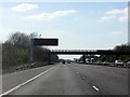
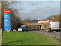
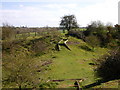
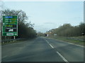
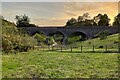
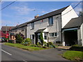
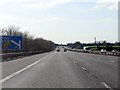
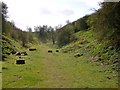
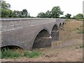
Newton and Biggin is a civil parish in Rugby borough, Warwickshire, situated approximately three miles north-east of Rugby town. The parish covers an area of 3.8 km² and lies near the A5 road, which marks the border with Leicestershire and Northamptonshire. This junction of three counties meets at Dow Bridge, where the A5 crosses the River Avon, placing the village in a distinct geographical position. Historically, the area was a township and chapelry within Clifton-on-Dunsmore parish, first described in the late nineteenth century. Houses here were built largely for workers in the nearby gravel extraction industry, which remains the main economic driver. The settlement includes the deserted medieval village of Biggin and the remains of Biggin Mill, a watermill whose physical traces survive today. A notable historical figure, Edward Cave, who founded the Gentleman's Magazine, was born in Newton. The parish is home to the Stag and Pheasant pub, the oldest building used as a public house in Warwickshire. Living in Newton and Biggin involves a blend of historical depth and industrial practicality. The northern end of the Great Central Walk follows the old theatre rail trackbed, offering accessible pedestrian routes. You can find sites of interest such as Roman town remains of Tripontium just north of the village. The area functions as a quiet residential spot close to the main transport artery but lacks a direct railway station. Rugby station lies roughly five kilometres to the south-west for those requiring rail links. The terrain and layout support a community defined by its proximity to the A5 and the surrounding countryside.
- Area Type
- Parish
- Area Size
- 3.8 km²
- Population
- Not available
- Population Density
- Not available
Demographics
The demographic profile of Newton and Biggin reflects a predominantly mature community. Fifty years of census data points to a median age of 70 years old, indicating a significant population of older residents. While specific percentages for individual age ranges are not detailed in the provided metrics, the overall age structure suggests the area serves as a retirement destination or a place for longevity. You will find that home ownership stands at 75%, meaning three out of four households own their property outright or with a mortgage. This high rate of ownership contrasts with areas where renting remains the primary arrangement. Accommodation types and household compositions break down by total figures available in the local records, though specific numbers for individual tenure types are not listed. The ethnic makeup, religion, and detailed household breakdown are recorded as total categories in the current dataset, indicating a mixed community without a single dominant demographic feature being highlighted for exclusion. The area does not exhibit extreme diversity markers in the immediate data provided. Deprivation levels are not explicitly quantified in the current assessment, so you should evaluate this against general Warwickshire averages. The population density within the 3.8 km² boundary suggests a spread-out living environment rather than a dense urban cluster. Most residents are settled in their homes, given the high ownership rate.
Household Size
Accommodation Type
Tenure
Ethnic Group
Religion
Household Composition
Age
Household Deprivation
NS-SEC
Explore more demographic insights in this area
Go to Demographics tabPlanning
Planning Constraints
- Flood RiskPremium
- Ramsar Wetland SitesPremium
- Area of Outstanding Natural BeautyPremium
- Protected Nature ReservePremium
- Protected WoodlandPremium
- Crime RiskPremium