Area Overview for Naunton Beauchamp
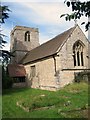
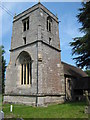
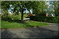
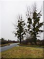
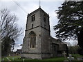
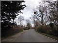
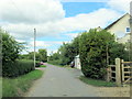
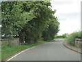
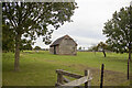
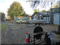
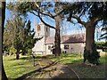
Photos of Naunton Beauchamp

Area Information
Living in Naunton Beauchamp means residing within a compact civil parish that spans just 4.2 km². This small footprint defines a community where residents know each other, creating a tight-knit environment rather than a sprawling suburb. The area serves as a distinct pocket within the broader housing landscape, offering a specific type of rural living experience. You will find a locality where the density of housing is managed by its limited size, ensuring no one has to travel far for their immediate neighbours. Prospective buyers should understand that Naunton Beauchamp is a place defined by its boundaries and the people who call it home. The civil parish structure suggests a level of local governance and community organisation common in rural England. Daily life here revolves around a shared sense of place because the area is physically small enough for visibility and familiarity. You are purchasing into a settled environment where the scale of the parish dictates the pace of life. The character of homes in Naunton Beauchamp is shaped by this restricted area size. Residents enjoy a setting that feels secluded yet accessible within the village structure. The parish designation means you are part of a recognised administrative unit with its own distinct identity. This makes Naunton Beauchamp a practical choice for those seeking a small, defined home with clear boundaries. The total area ensures that resources and community space are shared efficiently among all inhabitants.
- Area Type
- Parish
- Area Size
- 4.2 km²
- Population
- Not available
- Population Density
- Not available
Demographics
The community in Naunton Beauchamp is defined by an older population profile. The median age for residents is 70 years, indicating a neighbourhood that has matured significantly over time. This demographic shift suggests a village where family homes often pass down through generations or are occupied by retirees seeking a slower pace. You will find that the most common age grouping aligns with this high median, reflecting a settlement that attracts older adults rather than young professionals. Home ownership stands at 89%, which creates a very different dynamic from typical rental markets elsewhere. This high figure means the vast majority of people in Naunton Beauchamp own their homes outright. Such a statistic points to long-term stability and reduced tenant turnover in the local estate. The community composition is dominated by owner-occupiers who have likely stayed in the parish for decades. This contrasts sharply with areas where rental properties form a significant portion of the stock. Accommodation types and household composition further illustrate this static nature. The data confirms that total accommodation reflects a traditional village structure rather than modern developments. You can expect a population where diversity in age is skewed heavily toward seniors. This demographic reality shapes local services, social activities, and the general atmosphere of Naunton Beauchamp. Residents benefit from established social networks but may find the age profile less varied than in urban districts.
Household Size
Accommodation Type
Tenure
Ethnic Group
Religion
Household Composition
Age
Household Deprivation
NS-SEC
Explore more demographic insights in this area
Go to Demographics tabPlanning
Planning Constraints
- Flood RiskPremium
- Ramsar Wetland SitesPremium
- Area of Outstanding Natural BeautyPremium
- Protected Nature ReservePremium
- Protected WoodlandPremium
- Crime RiskPremium