Area Overview for Malvern
Photos of Malvern

Area Information
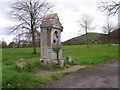
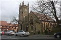
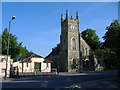
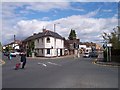
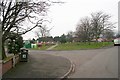
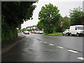
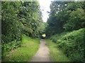
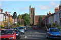
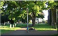
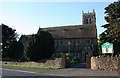
Great Malvern serves as the historic centre of the wider Malvern parish, situated at the foot of the Malvern Hills in Worcestershire. This civil parish covers an area of 19.9 km² and supports a population of 13,831 residents. You will find the town located approximately eight miles west of Worcester, acting as a key cultural hub for the local district. The landscape features the distinctive Worcestershire Beacon and North Hill, defining the setting for living in Malvern. The town's identity is deeply rooted in its history as a spa destination, a role maintained since the 17th century through its reputation for bottled water and natural scenery. You reside within a community that blends residential life with significant tourism and light industry. Great Malvern functions as a market town while retaining the character of a resort destination. The architecture reflects this dual nature, featuring the extensive plains of St Ann's Well and the historic ruins of the 11th-century prior. Daily life balances traditional heritage with modern necessities, anchored by Great Malvern Priory, which houses the largest collection of 15th-century stained glass in England. Homes in Malvern offer proximity to this landmark and the rolling hills, providing access to outdoor recreation alongside cultural attractions. The area operates as the administrative centre for the Malvern Hills district, consolidating local governance within the parish boundaries.
- Area Type
- Parish
- Area Size
- 19.9 km²
- Population
- 13831
- Population Density
- 693 people/km²
Demographics
The community in Malvern presents a distinctly mature profile, with a median age of 70 years. This figure indicates a settlement that has attracted older generations, creating a specific dynamic for living in Malvern. You will encounter a significant proportion of retirees within the residential fabric of the parish. Home ownership stands at 71%, meaning nearly three out of four residents own their property outright. This high rate suggests stability within households and a market driven by long-term residents rather than short-term tenants. The area accommodates a population of 13,831 people across 19.9 km², resulting in a density of 693 people per square kilometre. This density reflects a compact urban layout typical of historic spa towns. While the data does not specify detailed breakdowns for ethnicity, religion, or specific age ranges beyond the median, the overall demographic picture points toward an established, settled community. The high home ownership rate contrasts with areas where rental markets dominate, indicating that buying properties in Malvern often involves joining existing families or building a retirement home. Your neighbours are likely to be individuals who have planted roots in the parish for an extended period.
Household Size
Accommodation Type
Tenure
Ethnic Group
Religion
Household Composition
Age
Household Deprivation
NS-SEC
Explore more demographic insights in this area
Go to Demographics tabPlanning
Planning Constraints
- Flood RiskPremium
- Ramsar Wetland SitesPremium
- Area of Outstanding Natural BeautyPremium
- Protected Nature ReservePremium
- Protected WoodlandPremium
- Crime RiskPremium