Area Overview for Little Packington
Photos of Little Packington

Area Information
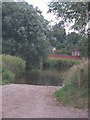
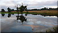
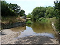
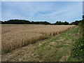
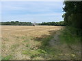
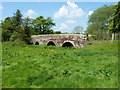
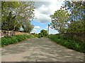
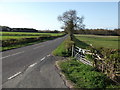
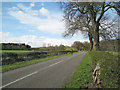
Little Packington is a civil parish located in the North Warwickshire district of Warwickshire, England. This hamlet sits just northwest of Great Packington, near the boundaries of Packington Park and on the banks of the River Blythe. The settlement spans an area of 4.6 square kilometres, encompassing a landscape defined by its historical roots and rural setting. You will find the parish situated at coordinates approximately 52.45°N 1.683°W, placing it firmly within the Arden Forest region. Daily life here revolves around a quiet, semi-rural existence rather than urban convenience. The area retains the character of a small nucleated settlement that has evolved over nearly a millennium. Its distinctiveness lies in its tangible connection to the past, visible through surviving earthworks and ancient structures. Residents enjoy proximity to significant green spaces like Packington Park while living within a defined parish boundary. This setting appeals to those seeking a location where history and nature intersect without the pressure of a large population. The parish offers a specific type of countryside living where the boundaries between past and present remain clearly visible in the landscape.
- Area Type
- Parish
- Area Size
- 4.6 km²
- Population
- Not available
- Population Density
- Not available
Demographics
The community of Little Packington reflects a settlement with a distinct demographic profile. The median age of residents is 70 years, indicating a population that leans heavily towards older demographics. This age distribution suggests a community where you will primarily encounter retirees or long-term residents rather than young families moving in for childcare. Home ownership stands at 69%, a figure that places the area clearly in the territory of owner-occupied property rather than private rented accommodation. The high rate of ownership correlates with the older age profile, as established residents tend to retain their properties into retirement. Household and accommodation types are recorded generally for the total population, reinforcing the stable nature of the area. There is no indication of a high turnover of tenants or a surge in new-build developments targeting young professionals. The demographic reality is one of continuity. You should expect a neighbourhood where community ties are likely rooted in decades of residency rather than transient work patterns. Planning applications or demographic shifts tend to be slower paced in environments where the majority of homes sit with their original owners. This stability creates a specific atmosphere for anyone considering buying a home in Little Packington.
Household Size
Accommodation Type
Tenure
Ethnic Group
Religion
Household Composition
Age
Household Deprivation
NS-SEC
Explore more demographic insights in this area
Go to Demographics tabPlanning
Planning Constraints
- Flood RiskPremium
- Ramsar Wetland SitesPremium
- Area of Outstanding Natural BeautyPremium
- Protected Nature ReservePremium
- Protected WoodlandPremium