Area Overview for Leek
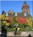
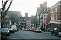
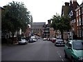
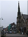
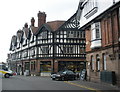
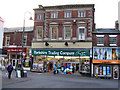
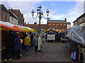
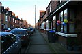
Photos of Leek
Area Information
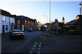
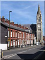
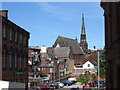
Living in Leek means settling into a built-up area defined by its modest scale and distinct character. The town covers just 5.4 km², creating an environment where the community remains tightly knit rather than spread across sprawling suburbs. You will find around 3,505 residents calling this space home, resulting in a population density of 644 people per square kilometre. This figure indicates a balanced urban feel; you are close enough to neighbours to foster local connections but not so densely packed as to feel cramped. Leek sits firmly within England, offering a traditional settlement pattern that suits those who prefer a manageable town centre over the anonymity of a larger city. Daily life here revolves around this compact geography, making access to key services quick and straightforward. Whether you value easy commutes, a straightforward layout, or a sense of community, the physical boundaries of Leek support a lifestyle that does not rely on vast sprawl. For a homebuyer, this geographical reality means that the distance between your house and your local shops, schools, or green spaces is often a matter of minutes rather than miles.
- Area Type
- Built Up Area 250
- Area Size
- 5.4 km²
- Population
- 3505
- Population Density
- 644 people/km²
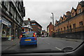
Daily life in Leek is supported by a cluster of retail amenities placed within practical reach of every resident. The town features five notable retail venues, including Iceland Leek, Co-op West, and Aldi Leek. These supermarkets provide the core necessity for food shopping, ensuring that you never need to travel far for groceries or household supplies. At the other end of the spectrum, transport connections extend towards Cheddleton, a metro-adjacent town that serves as a key junction for longer journeys. This metro link offers a straightforward option for those needing to travel beyond the local town centre to access wider regional transport networks. The combination of local retail giants and transport nodes creates a self-sufficient lifestyle where most daily errands can be completed locally. You can walk to the nearest store or take a short drive to major outlets, keeping travel time minimal. The presence of these specific businesses defines the commercial character of Leek, offering practical convenience over high-end luxury shopping. Residents enjoy a straightforward ecosystem where essential needs are met quickly and efficiently.
Amenities
Schools
Families considering Leek have access to five nearby primary schools, all of which serve the local catchment areas within the town boundaries. You will find Leek First School listed among the options, as will Westwood First School and Woodcroft First School. These institutions provide foundational education for children growing up in the area before they transition to secondary education outside the immediate town. The school list also includes Beresford Memorial CofE (A) First School and All Saints CofE (A) First School. The presence of Church of England schools alongside standard primary institutions indicates a diverse educational offering rooted in the town's history. While specific Ofsted ratings are not included in the current data, the existence of five named primary schools ensures sufficient capacity for local families. The concentration of these schools within the 5.4 km² area means that many pupils can attend within walking distance or a short bus ride. For parents, this density of primary education options provides flexibility when choosing a location for a home. You can select a property that aligns with the specificCatchment area of your preferred school without needing to commute extensively from outside the town limits.
| Rank | School | Type | Entry gender | Ages |
|---|
Explore more schools in this area
Go to Schools tabDemographics
The community profile of Leek presents a clear picture of an established, mature neighbourhood. The median age in this area is 70, a figure that clearly distinguishes Leek from younger, professional urban centres. This demographic reality suggests that the town caters primarily to older adults and retirees who have built long-term roots here. Despite this age skew, the data shows that 70% of households own their homes outright or have a mortgage. This high level of home ownership reinforces the stability of the local population and suggests a market driven by long-term residents rather than short-term renters. You will not find significant data on ethnicity or religion within the current records, but the steady home ownership rate indicates a settled populace. The household composition data confirms that the town maintains a consistent residential status without the volatility often seen in student towns or transient industrial hubs. For families or buyers seeking a permanent base, the low vacancy implied by these figures is significant. It points to an area where people stay and invest in their surroundings rather than moving on frequently.
Household Size
Accommodation Type
Tenure
Ethnic Group
Religion
Household Composition
Age
Household Deprivation
NS-SEC
Explore more demographic insights in this area
Go to Demographics tabPlanning
Planning Constraints
- Crime RiskPremium