Area Overview for LE17 6AS
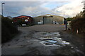
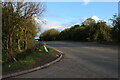
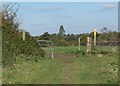
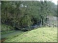
Photos of LE17 6AS
Area Information
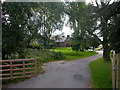
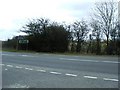
Living in LE17 6AS, a small postcode area in Warwickshire, means inhabiting a rural village with a distinct character shaped by history and community. Churchover, the village at its heart, sits four miles north of Rugby, straddling the border with Leicestershire. With a population of 1,485 and a low density of 71 people per square kilometre, it retains a quiet, unhurried pace. The area is defined by its pastoral roots, with red-brick homes and a triangular village green known as a “Godcake,” surrounded by a large chestnut tree. This is a place where agriculture and heritage coexist, with landmarks like Holy Trinity Church, medieval in origin, and Coton House, a late 18th-century estate. Daily life here is grounded in tradition, with a close-knit community structure and access to nearby towns like Rugby for employment or shopping. The village’s small size and historic charm make it appealing to those seeking a slower, rural lifestyle without complete isolation from urban amenities.
- Area Type
- Postcode
- Area Size
- Not available
- Population
- 1485
- Population Density
- 71 people/km²
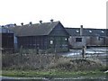
The property market in LE17 6AS is dominated by owner-occupied homes, with 81% of residents living in properties they own. The area’s accommodation type is primarily houses, reflecting its rural character and the absence of high-density housing. This contrasts with urban areas where flats or apartments might predominate. The small size of the postcode area—covering a cluster of approximately 100 houses—means the housing stock is limited, with fewer new developments. Buyers should consider the scarcity of properties and the likelihood of competition from long-term residents. The focus on owner-occupation suggests a stable market, but the lack of rental properties may limit options for those seeking flexibility. For those prioritising space and a traditional setting, the area offers a distinct alternative to larger towns, though proximity to Rugby provides access to more varied housing choices.
House Prices in LE17 6AS
No properties found in this postcode.
Energy Efficiency in LE17 6AS
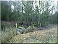
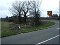
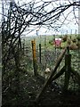
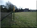
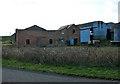
The lifestyle in LE17 6AS is shaped by its rural setting and proximity to small-town amenities. Within practical reach are retail outlets like Aldi Brownsover, M&S Rugby Moto SF, and Tesco Rugby, offering everyday shopping needs. The village’s triangular green, surrounded by a chestnut tree, serves as a focal point for community gatherings, while historic sites like Holy Trinity Church and Coton House add cultural depth. The area’s character is defined by its agricultural heritage, with Leatherlands Barn and the village green preserving a pastoral identity. For leisure, the nearby village green and historic buildings provide informal spaces for walking or reflection. While the range of amenities is modest, they are sufficient for a low-maintenance lifestyle, with Rugby offering more extensive options for dining, entertainment, and services.
Amenities
Schools
The nearest school to LE17 6AS is Harborough Magna CofE First School, a primary institution serving the surrounding area. While no Ofsted rating is provided, the presence of a primary school within practical reach is a key consideration for families. The absence of secondary schools in the immediate vicinity means parents may need to look further afield, such as Rugby, for comprehensive education. This dynamic reflects the village’s small size and focus on rural living, where schools are fewer but often community-centred. The mix of school types—only primary in this case—highlights the need for strategic planning when considering long-term family needs. For those prioritising proximity to educational facilities, the primary school is a practical asset, though secondary schooling will require additional commuting.
| Rank | School | Type | Entry gender | Ages |
|---|
Explore more schools in this area
Go to Schools tabDemographics
The population of LE17 6AS is predominantly adults aged 30–64, with a median age of 47, reflecting a mature, settled community. Home ownership is high at 81%, indicating a strong preference for long-term residency over renting. The area is characterised by houses rather than flats, aligning with its rural nature. The predominant ethnic group is White, though specific data on diversity is not provided. This demographic profile suggests a community focused on stability and family life, with limited generational turnover. The absence of detailed deprivation data means quality of life can only be inferred from the available metrics. The age range and home ownership rate imply a population less reliant on public services and more invested in local infrastructure, though this may also mean fewer amenities tailored to younger families or transient residents.
Household Size
Accommodation Type
Tenure
Ethnic Group
Religion
Household Composition
Age
Household Deprivation
NS-SEC
Explore more demographic insights in this area
Go to Demographics tabPlanning
Planning Constraints
- Flood RiskPremium
- Ramsar Wetland SitesPremium
- Area of Outstanding Natural BeautyPremium
- Protected Nature ReservePremium
- Protected WoodlandPremium