Area Overview for Kinwarton
Photos of Kinwarton
Area Information
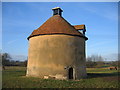
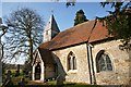
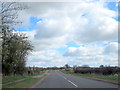
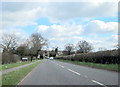
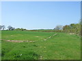
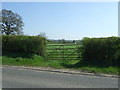
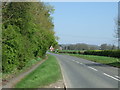
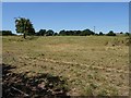
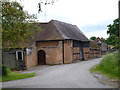
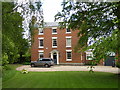
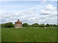
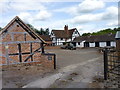
Kinwarton is a civil parish situated in the valley of the River Alne within Warwickshire, to the north-east of the market town of Alcester. This historic settlement sits on coordinates 52.218622, -1.856771 with a postcode of B49 6DW, covering an area of 1.9 km². The terrain here is mostly low-lying, reaching a maximum altitude of 206 ft. Because of this geography, some fields near the river remain liable to flooding, a fact residents should note when considering long-term stability. The 2011 Census recorded a population of 1,082 for the parish, reflecting a small, tight-knit community rather than a bustling town. Life in Kinwarton revolves around its rich history and proximity to the River Alne. The ground includes visible earthworks from the post-medieval period, and the site of a former manor house lies just 100m north of the dovecote. Local daily life is shaped by the presence of the 13th-century parish church of St. Mary the Virgin and the National Trust-owned Kinwarton Dovecote. For those living in Kinwarton, the environment offers quiet surroundings defined by agricultural use and open fields rather than dense urban development. The area functions as a traditional village, providing a retirement-focused atmosphere among older trees and historic farmsteads like Glebe Farm.
- Area Type
- District Borough Unitary Ward
- Area Size
- 1.9 km²
- Population
- Not available
- Population Density
- Not available
Demographics
The community in Kinwarton is defined by a median age of 70, confirming that the area serves as a retirement destination. This demographic cluster means the majority of residents fall into the Age: Total category, indicating a population focused on later life stages. With a home ownership rate of 82%, most households consist of individuals or couples who have purchased their residences outright rather than renting. This high level of ownership stimulates a stable local economy and suggests long-term commitment to the village. Accommodation types in Kinwarton align closely with the needs of an older population. The data indicates that the total household composition reflects families and singles typical of a retirement village. Diversity in the area predominantly reflects local ethnic groups without significant immigrant influx, consistent with a rural Midlands village. Approximately 82% of homes are owner-occupied, while the remaining 18% likely comprise long-term rentals or housing associations. This distribution shapes the social fabric of Kinwarton, fostering connections between neighbours who have lived in their properties for decades. The demographic profile creates a peaceful environment, though it also limits the number of young families moving to schools near Kinwarton in significant numbers.
Household Size
Accommodation Type
Tenure
Ethnic Group
Religion
Household Composition
Age
Household Deprivation
NS-SEC
Explore more demographic insights in this area
Go to Demographics tabPlanning
Planning Constraints
- Flood RiskLocked
- Ramsar Wetland SitesLocked
- Area of Outstanding Natural BeautyLocked
- Protected Nature ReserveLocked
- Protected WoodlandLocked
- Crime RiskLocked