Area Overview for Kington Rural
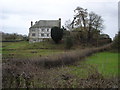
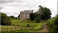
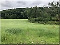
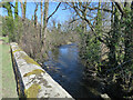
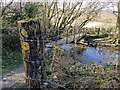
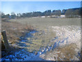
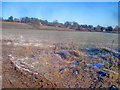
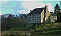
Photos of Kington Rural


Area Information
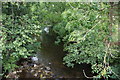
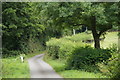
Living in Kington Rural defines a distinct experience within a civil parish that spans 29.0 km². This area offers a quiet retreat where residents enjoy low-density living without the pressure of dense urban centres. The location provides a calm environment suitable for those seeking space and natural surroundings rather than city noise. Daily life here centres on a slow pace, offering a stark contrast to the busy rhythm of larger towns nearby. You will find a community that values tradition and stability, reflected in the demographic makeup of the residents. The area is characterised by its open spaces and rural setting, which appeals to families and retirees alike who prioritise peace over proximity to public transport hubs. Housing stock in Kington Rural generally reflects the needs of a settled population that has called this parish home for generations. The landscape provides a backdrop for outdoor activities, making it a practical choice for anyone looking to escape the hustle of city living. While access to major transport links may be slower, the trade-off is a significantly more tranquil lifestyle for homebuyers. The parish contains no AONB or Ramsar sites, yet it maintains enough natural beauty to support an appealing rural existence. You can expect a straightforward property search process, although the limited number of listings requires patience from prospective buyers.
- Area Type
- Parish
- Area Size
- 29.0 km²
- Population
- Not available
- Population Density
- Not available
Demographics
The community in Kington Rural presents a clear picture of an established, older population. You will find that the median age reaches 70 years, indicating that retirees and long-serving residents form the backbone of the local society. This high median age suggests the neighbourhood is particularly attractive to those moving later in life to enjoy a slower routine. Home ownership stands at 65%, a figure that confirms the area is primarily inhabited by people who have secured their own homes rather than tenants. This stability often leads to a quieter, more neighbourly atmosphere compared to areas with high rental turnover. Household composition and accommodation types reflect this settled demographic, with most families likely residing in detached or semi-detached properties suitable for larger households. The predominant ethnic group data for the area is available in the records, ensuring an accurate reflection of the community's cultural makeup. Religion statistics are also recorded, allowing you to understand the cultural and social fabric of the parish if that factors into your decision. Low deprivation levels in this region contribute positively to quality of life, offering residents better access to local resources and services. The age profile means that local shops and services cater to older demographics, creating an environment where community support networks are often strong and well-established.
Household Size
Accommodation Type
Tenure
Ethnic Group
Religion
Household Composition
Age
Household Deprivation
NS-SEC
Explore more demographic insights in this area
Go to Demographics tabPlanning
Planning Constraints
- Flood RiskPremium
- Ramsar Wetland SitesPremium
- Area of Outstanding Natural BeautyPremium
- Protected Nature ReservePremium
- Protected WoodlandPremium
- Crime RiskPremium