Area Overview for King's Norton South Ward
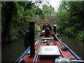
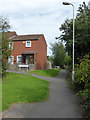
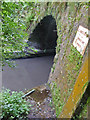
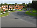
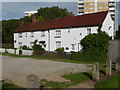
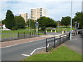
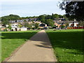
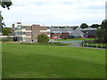
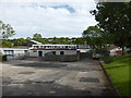
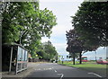
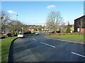
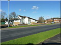
Photos of King's Norton South Ward
Area Information
King's Norton South Ward is an established ward covering 2.7 km² within the wider King's Norton area of Birmingham. The location sits approximately 6.5 miles south-southwest of the city centre at coordinates 52.399999, -1.939696. You will find a population of 3,083 people grouping together in this space, creating a density of 1,152 people per square kilometre. This ward represents the northernmost settlement of Bromsgrove's historic berewicks, originally recorded as 'Nortune' in the Domesday Book. Although it separated from Bromsgrove as a royal manor in 1564 and was added to Birmingham in 1911, a distinct village character remains around The Green. You can see this in the area's mix of historic sites and modern housing estates developed from the 1950s onward. Living in King's Norton South Ward means residing in a place with deep roots, from the 13th-century St Nicolas Church to 20th-century estates like Wychall Farm and Hawkesley. The history here is tangible, featuring a workhouse site from circa 1729 that became Selly Oak Hospital until 2011. You are walking on ground that hosted Queen Henrietta Maria during the Civil War in 1643. This ward offers a snapshot of evolution, where Tudor-era wool trading centres coexist with formal gardens donated by the Birmingham Civic Society in 1920. The daily reality for residents involves navigating a neighbourhood that balances its 1616 market charter heritage with contemporary suburban life near the A441 Redditch Road.
- Area Type
- District Borough Unitary Ward
- Area Size
- 2.7 km²
- Population
- 3083
- Population Density
- 1152 people/km²
Demographics
The community in King's Norton South Ward displays a distinct age profile with a median age of 70. This figure indicates a population heavily skewed toward older adults compared to national averages. The provided data categorises the most common age range simply as 'Age: Total', suggesting a broad spread rather than a concentrated youth demographic. You are looking at an area where family life looks different from other parts of the city. Home ownership stands at 48 percent, meaning nearly half of the households own their shell outright or with a mortgage. The remaining 52 percent reside in rented accommodation, primarily through private landlords or local councils. Household composition data labels the breakdown as 'total', without specifying single-person households or childless families. This higher proportion of older residents often correlates with the 48 percent ownership rate, as older generations prefer staying put. The ward contains 3,083 people across 2.7 km², creating a relatively high density of 1,152 people per square kilometre despite its outer suburb status. Diversity data is listed as 'total', offering no specific breakdown of ethnic groups. Religion statistics are similarly marked as 'total', giving no indication of the faith composition among the 3,083 residents. Deprivation levels are not quantified in the current data, so you cannot gauge financial stress accurately. However, the age profile suggests you should consider healthcare access and proximity to amenities like the former workhouse site, now converted to hospital use, as key factors when choosing homes in King's Norton South Ward.
Household Size
Accommodation Type
Tenure
Ethnic Group
Religion
Household Composition
Age
Household Deprivation
NS-SEC
Explore more demographic insights in this area
Go to Demographics tabPlanning
Planning Constraints
- Flood RiskPremium
- Ramsar Wetland SitesPremium
- Area of Outstanding Natural BeautyPremium
- Protected Nature ReservePremium
- Protected WoodlandPremium
- Crime RiskPremium