Area Overview for Hyde Lea and Coppenhall
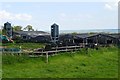
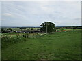
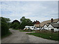
Photos of Hyde Lea and Coppenhall


Area Information
Hyde Lea and Coppenhall occupies 32.5 hectares as a built-up area within Staffordshire. It sits at the far end of the traditional homebuying journey for those seeking growth and activity. The median age in the area is 70, which defines the character of daily life. Most residents are in the age group labelled as Total rather than a specific young or middle bracket. This demographic profile means the community moves differently than neighbouring town centres. Eighty-three per cent of households own their homes, suggesting stability and a lack of speculative turnover. You will find streets settled by people who intend to stay for a long time. The area size limits the scope for sudden expansion, preserving a quiet atmosphere. Living in Hyde Lea and Coppenhall offers a distinct alternative to bustling city living. The layout reflects a space where larger generations have dominated for decades. You do not find young professional clusters here in the same way as other built-up zones. Instead, the environment suits those prioritising peace over proximity to high-energy commercial hubs. The absence of diverse age groups reshapes local services and social interactions. When you visit, notice how the population structure dictates the pace of neighbourhood life. This simplicity ensures that the core experience remains consistent year after year.
- Area Type
- Built Up Area 250
- Area Size
- 32.5 hectares
- Population
- Not available
- Population Density
- Not available
Daily life in Hyde Lea and Coppenhall revolves around a selection of nearby amenities within practical reach. Retail options are limited to five primary locations. You can shop at Spar, Co-op Rising, and Tesco Stafford. These venues cover basic necessities for the older demographic prevalent in the area. The small number of shops indicates a reliance on essential goods rather than diverse leisure outlets. Rail transport connects you to Stafford Railway Station and Penkridge Railway Station. These two stations facilitate journeys beyond the local area. Residents can access wider networks for business or leisure trips. While the immediate neighbourhood lacks a pub scene or cinema listed in the nearby amenities, the railway serves as a gateway to such services. Living here means planning trips for culture or dining outside the immediate 32.5-hectare zone. The convenience of daily errands is anchored by the three main supermarkets. You do not find large parks or dedicated leisure centres listed as immediate amenities. The lifestyle is defined by convenience shopping and rail mobility. This setup suits residents who prioritise spending time away from the house rather than searching for local entertainment. The character of the area remains focused on practical mobility and essential retail.
Amenities
Schools
| Rank | School | Type | Entry gender | Ages |
|---|
Explore more schools in this area
Go to Schools tabDemographics
The community profile of Hyde Lea and Coppenhall is defined by advanced age. Your average resident reaches a median age of 70 years old. This figure is not an estimate but a calculated reality for the area. Most residents fall into the broad age category marked as Total, indicating a lack of younger demographic clusters. Household composition mirrors this older profile without specific breakdowns into single-person or family units. Diversity in ethnicity and religion remains absent from the provided statistics. Home ownership stands as a dominant feature at 83 per cent. This metric confirms that the majority of residents hold their property free of rent. Such a high level of ownership usually implies a stable population with deep local roots. You can expect neighbours who have lived through multiple economic cycles. The accommodation types available do not show a split between social and private sectors in the data. Instead, the focus rests heavily on owner-occupied stock. This stability influences the social fabric, creating an environment where long-term residents shape community norms. If you seek an area driven by families with young children or transient professionals, Hyde Lea and Coppenhall does not align with that model.
Household Size
Accommodation Type
Tenure
Ethnic Group
Religion
Household Composition
Age
Household Deprivation
NS-SEC
Explore more demographic insights in this area
Go to Demographics tabPlanning
Planning Constraints
- Crime RiskPremium