Area Overview for HR9 7JZ
Photos of HR9 7JZ
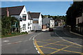
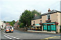
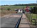
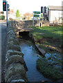
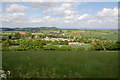
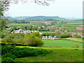
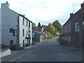
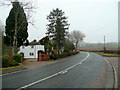
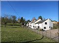
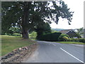
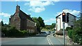
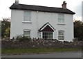
104 photos from this area
Area Information
Key information about the HR9 7JZ including its size, population, and administrative classification.
- Area Type
- Postcode
- Area Size
- 17.0 hectares
- Population
- 1899
- Population Density
- 85 people/km²
House Prices in HR9 7JZ
29
Properties
£288,389
Average Sold Price
£75,000
Lowest Price
£527,500
Highest Price
Showing 29 properties
| Address | Type | Beds | Baths | Last Sale Price | Last Sale Date | |
|---|---|---|---|---|---|---|
| Brook House, Lea Crossroads, Lea, HR9 7JZ | Detached | 5 | 4 | £490,000 | Jun 2024 | |
| The Old Granary, B 4222 From Rudhall Brook To Gloucestershire Boundary, Lea, HR9 7JZ | Detached | 4 | 2 | £355,000 | Jul 2018 | |
| Lea House, A 40 Lea From B 4224 To Gloucestershire Boundary, Lea, HR9 7JZ | Semi-detached | 6 | 1 | £405,000 | Jun 2015 | |
| Green Acres, Lea To Ecleswall Court Road, Lea, HR9 7JZ | Bungalow | - | - | £335,000 | Aug 2010 | |
| Coopers Barn, Rock Farm Lane, Lea, HR9 7JZ | Semi-detached | 4 | 2 | £527,500 | Nov 2009 | |
| Orchard Lea, Rock Farm Lane, Lea, HR9 7JZ | house | 4 | 1 | £185,000 | Dec 2007 | |
| April Rise, Rock Farm Lane, Lea, HR9 7JZ | Detached | - | - | £127,000 | Jan 1998 | |
| Bronte Cottage, Rock Farm Lane, Lea, HR9 7JZ | Semi-detached | - | - | £96,000 | May 1997 | |
| Nourse Cottage, Rock Farm Lane, Lea, HR9 7JZ | Semi-detached | 3 | 1 | £75,000 | Jan 1995 | |
| Derwent House, A 40 Lea From B 4224 To Gloucestershire Boundary, Lea, HR9 7JZ | Detached | 3 | 2 | - | - |
Page 1 of 3
Energy Efficiency in HR9 7JZ
Amenities
Schools
| Rank | School | Type | Entry gender | Ages |
|---|
Explore more schools in this area
Go to Schools tabDemographics
Household Size
Two person
most common
Accommodation Type
Houses
most common
Tenure
73
majority
Ethnic Group
White
most common
Religion
N/A
most common
Household Composition
N/A
most common
Age
47
median
Adults (30-64 years)
most common
Household Deprivation
N/A
with no deprivation
NS-SEC
43
in Lower managerial occupations
Explore more demographic insights in this area
Go to Demographics tabPlanning
Planning Constraints
- Flood RiskPremium
- Ramsar Wetland SitesPremium
- Area of Outstanding Natural BeautyPremium
- Protected Nature ReservePremium
- Protected WoodlandPremium