Area Overview for HR9 6SL
Photos of HR9 6SL


Area Information
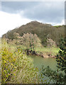
HR9 6SL is a small, tightly knit residential cluster in England, home to 1,585 people spread across a low-density area of just over 19 square kilometres. The community is characterised by its stability, with 81% of residents owning their homes, reflecting a long-standing local presence. Daily life here is shaped by the area’s quiet, suburban charm, where families and older adults form the majority of the population. The median age of 47 suggests a mature demographic, with most residents falling between 30 and 64 years old. While the area lacks major urban amenities, its compact size fosters a sense of familiarity, with local shops and schools within easy reach. The absence of environmental constraints such as protected woodlands or AONB designations means development pressures are minimal, preserving the area’s residential tranquillity. For those seeking a low-maintenance, family-friendly environment with a strong sense of community, HR9 6SL offers a straightforward, unpretentious lifestyle.
- Area Type
- Postcode
- Area Size
- Not available
- Population
- 1585
- Population Density
- 81 people/km²
The property market in HR9 6SL is dominated by owner-occupied homes, with 81% of residents living in properties they own. This high rate of home ownership suggests a community of long-term residents rather than a transient rental market. The accommodation type is primarily houses, which aligns with the area’s suburban character and the preferences of its mature demographic. For buyers, this means the housing stock is likely to be older, with fewer modern developments, and the market may be more competitive for those seeking a family home. The small size of the area means the immediate surroundings are critical for property hunters, as options are limited. Prospective buyers should consider nearby postcode areas for a broader selection, though HR9 6SL’s low environmental constraints and safety profile make it an attractive, if niche, option for those prioritising stability over rapid growth.
House Prices in HR9 6SL
No properties found in this postcode.
Energy Efficiency in HR9 6SL
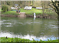
Residents of HR9 6SL have access to a modest selection of retail amenities within walking distance, including Budgens Whitchurch, Spar, and Morrisons Daily. These stores provide essential shopping options for groceries, household items, and everyday needs, reducing the necessity for long journeys to larger towns. While the data does not mention dining or leisure facilities, the presence of multiple retail outlets suggests a basic level of convenience for daily life. The area’s low population density and small size mean that leisure options such as parks or recreational spaces are not explicitly listed, but the absence of environmental constraints implies open spaces may be available nearby. For those prioritising practicality over luxury, the local amenities offer sufficient support for a simple, self-contained lifestyle.
Amenities
Schools
Residents of HR9 6SL have access to two primary schools within practical reach: Goodrich CofE Primary School and Whitchurch CofE Primary School. Both institutions cater to younger children, with Whitchurch CofE Primary School holding an outstanding Ofsted rating, reflecting its high standards of education and care. Goodrich CofE Primary School is also rated as good, ensuring families have access to quality schooling options. The presence of two primary schools within the area reduces the need for long commutes, making it easier for parents to balance work and family responsibilities. For families prioritising education, the combination of an outstanding-rated school and a second reliable option provides reassurance about the availability of consistent, high-quality early education. However, the data does not mention secondary schools, so parents planning for older children may need to look further afield.
| Rank | School | Type | Entry gender | Ages |
|---|---|---|---|---|
| 1 | Goodrich CofE Primary School | primary | N/A | N/A |
| 2 | Whitchurch CofE Primary School | primary | N/A | N/A |
| 3 | Goodrich CofE Primary School | primary | N/A | N/A |
Explore more schools in this area
Go to Schools tabDemographics
The population of HR9 6SL is predominantly composed of adults aged 30–64, with a median age of 47. This suggests a mature, established community where many residents are likely to be in their peak working years or nearing retirement. Home ownership is high, with 81% of properties occupied by their owners, indicating a stable housing market with limited rental activity. The area is largely composed of houses rather than flats, aligning with the preferences of older, family-oriented households. The predominant ethnic group is White, reflecting a homogenous demographic profile. While the data does not specify deprivation levels, the combination of high home ownership and a mature age profile suggests a population with relatively secure financial positions. This stability contributes to a low crime risk, with a safety score of 78 out of 100, reinforcing the area’s appeal for those prioritising security and long-term residency.
Household Size
Accommodation Type
Tenure
Ethnic Group
Religion
Household Composition
Age
Household Deprivation
NS-SEC
Explore more demographic insights in this area
Go to Demographics tabPlanning
Planning Constraints
- Flood RiskPremium
- Ramsar Wetland SitesPremium
- Area of Outstanding Natural BeautyPremium
- Protected Nature ReservePremium
- Protected WoodlandPremium
- Crime RiskPremium