Area Overview for HR9 6QN
Photos of HR9 6QN


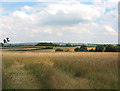

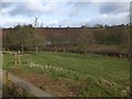
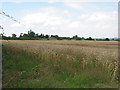
12 photos from this area
Area Information
Key information about the HR9 6QN including its size, population, and administrative classification.
- Area Type
- Postcode
- Area Size
- 29.4 hectares
- Population
- 1553
- Population Density
- 70 people/km²
House Prices in HR9 6QN
8
Properties
£714,999
Average Sold Price
£399,995
Lowest Price
£1,130,000
Highest Price
Showing 8 properties
| Address | Type | Beds | Baths | Last Sale Price | Last Sale Date | |
|---|---|---|---|---|---|---|
| Harewood House, Moraston Lane From C 1261, Dadnor And Picts Cross, HR9 6QN | Detached | 4 | 3 | £800,000 | Feb 2025 | |
| Kilchrenan, Moraston Lane From C 1261, Dadnor And Picts Cross, HR9 6QN | house | - | - | £399,995 | Aug 2024 | |
| Cartref, Moraston Lane From C 1261, Dadnor And Picts Cross, HR9 6QN | Detached | 4 | 3 | £415,000 | Jul 2023 | |
| Hawkshaw House, Moraston Lane From C 1261, Dadnor And Picts Cross, HR9 6QN | house | - | - | £1,130,000 | Apr 2022 | |
| Cradoc House, Moraston Lane From C 1261, Dadnor And Picts Cross, HR9 6QN | house | - | - | £775,000 | Apr 2021 | |
| Wellsbrook House, Moraston Lane From C 1261, Dadnor And Picts Cross, HR9 6QN | Detached | 5 | 4 | £770,000 | Mar 2021 | |
| The Pack House, Moraston Lane From C 1261, Dadnor And Picts Cross, HR9 6QN | Detached | - | - | - | - | |
| Pandora, Moraston Lane From C 1261, Dadnor And Picts Cross, HR9 6QN | house | - | - | - | - |
Energy Efficiency in HR9 6QN
Amenities
Schools
| Rank | School | Type | Entry gender | Ages |
|---|
Explore more schools in this area
Go to Schools tabDemographics
Household Size
Two person
most common
Accommodation Type
Houses
most common
Tenure
78
majority
Ethnic Group
White
most common
Religion
N/A
most common
Household Composition
N/A
most common
Age
47
median
Adults (30-64 years)
most common
Household Deprivation
N/A
with no deprivation
NS-SEC
39
in Lower managerial occupations
Explore more demographic insights in this area
Go to Demographics tabPlanning
Planning Constraints
- Flood RiskPremium
- Ramsar Wetland SitesPremium
- Protected Nature ReservePremium
- Protected WoodlandPremium