Area Overview for HR9 6JN
Photos of HR9 6JN
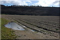

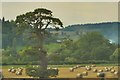
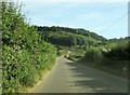


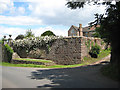
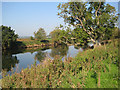
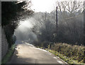
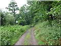
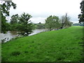
31 photos from this area
Area Information
Key information about the HR9 6JN including its size, population, and administrative classification.
- Area Type
- Postcode
- Area Size
- 3.2 km²
- Population
- 1585
- Population Density
- 81 people/km²
House Prices in HR9 6JN
21
Properties
£478,825
Average Sold Price
£199,500
Lowest Price
£663,500
Highest Price
Showing 21 properties
| Address | Type | Beds | Baths | Last Sale Price | Last Sale Date | |
|---|---|---|---|---|---|---|
| Rocklands Farm House, C 1258 Huntsham Road, Goodrich, HR9 6JN | Detached | 6 | 2 | £650,000 | Mar 2021 | |
| Rocklands Coach House, C 1258 Huntsham Road, Goodrich, HR9 6JN | Detached | 4 | 2 | £600,000 | Oct 2020 | |
| Rocklands House, C 1258 Huntsham Road, Goodrich, HR9 6JN | Semi-detached | - | - | £663,500 | Nov 2016 | |
| Ferry Cottage, C 1258 Huntsham Road, Goodrich, HR9 6JN | Detached | 3 | 2 | £470,000 | Mar 2016 | |
| Rocklands Lodge, C 1258 Huntsham Road, Goodrich, HR9 6JN | house | - | - | £289,950 | Oct 2011 | |
| Huntsham Cottage, C 1258 Huntsham Road, Goodrich, HR9 6JN | Detached | 2 | - | £199,500 | Aug 2005 | |
| Rocklands Farm, C 1258 Huntsham Road, Goodrich, HR9 6JN | Detached | 6 | 3 | - | - | |
| Mobile Home, Rocklands Farm, C 1258 Huntsham Road, Goodrich, HR9 6JN | Cottage | 1 | 1 | - | - | |
| Plot 1 Proposed Connversion Of Annexe To Farmhouse Huntsham Court, C 1258 Huntsham Road, Goodrich, HR9 6JN | Detached | - | - | - | - | |
| Coachmans Cottage, C 1258 Huntsham Road, Goodrich, HR9 6JN | Cottage | 3 | 1 | - | - |
Page 1 of 3
Energy Efficiency in HR9 6JN
Amenities
Schools
| Rank | School | Type | Entry gender | Ages |
|---|
Explore more schools in this area
Go to Schools tabDemographics
Household Size
Two person
most common
Accommodation Type
Houses
most common
Tenure
81
majority
Ethnic Group
White
most common
Religion
N/A
most common
Household Composition
N/A
most common
Age
47
median
Adults (30-64 years)
most common
Household Deprivation
N/A
with no deprivation
NS-SEC
43
in Lower managerial occupations
Explore more demographic insights in this area
Go to Demographics tabPlanning
Planning Constraints
- Flood RiskPremium
- Ramsar Wetland SitesPremium
- Protected Nature ReservePremium
- Protected WoodlandPremium