Area Overview for HR9 5TH
Photos of HR9 5TH
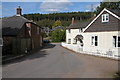
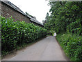
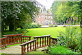

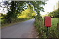

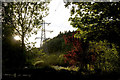
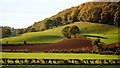
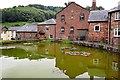
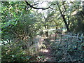
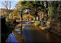
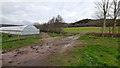
52 photos from this area
Area Information
Key information about the HR9 5TH including its size, population, and administrative classification.
- Area Type
- Postcode
- Area Size
- 71.3 hectares
- Population
- 1899
- Population Density
- 85 people/km²
House Prices in HR9 5TH
43
Properties
£397,900
Average Sold Price
£81,000
Lowest Price
£662,500
Highest Price
Showing 43 properties
| Address | Type | Beds | Baths | Last Sale Price | Last Sale Date | |
|---|---|---|---|---|---|---|
| Banners Cottage, C 1275 The Hill Farm To Bill Mills, Pontshill, HR9 5TH | Cottage | 3 | 1 | £585,000 | Jun 2023 | |
| Mill Cottage At Bill Mills, C 1275 The Hill Farm To Bill Mills, Pontshill, HR9 5TH | Cottage | 4 | 3 | £662,500 | Jan 2022 | |
| Kingfisher Cottage, C 1275 The Hill Farm To Bill Mills, Pontshill, HR9 5TH | Terraced | 3 | 1 | £240,000 | Sep 2021 | |
| Stream Cottage, C 1275 The Hill Farm To Bill Mills, Pontshill, HR9 5TH | Semi-detached | 3 | 2 | £421,000 | Dec 2020 | |
| Sunnyside Cottage, C 1275 The Hill Farm To Bill Mills, Pontshill, HR9 5TH | Detached | - | - | £81,000 | Jan 2000 | |
| Millers Cottage, Bill Mills, C 1275 The Hill Farm To Bill Mills, Pontshill, HR9 5TH | Terraced | 2 | 1 | - | - | |
| The Forge, Bill Mills, Pontshill, HR9 5TH | house | 2 | 1 | - | - | |
| Wintles, Bill Mills, Pontshill, HR9 5TH | Terraced | 4 | 3 | - | - | |
| Brooklyn Cottage, Bill Mills, C 1275 The Hill Farm To Bill Mills, Pontshill, HR9 5TH | Terraced | 3 | 2 | - | - | |
| Ross Lodge, C 1275 The Hill Farm To Bill Mills, Pontshill, HR9 5TH | Detached | 19 | 1 | - | - |
Page 1 of 5
Energy Efficiency in HR9 5TH
Amenities
Schools
| Rank | School | Type | Entry gender | Ages |
|---|
Explore more schools in this area
Go to Schools tabDemographics
Household Size
Two person
most common
Accommodation Type
Houses
most common
Tenure
73
majority
Ethnic Group
White
most common
Religion
N/A
most common
Household Composition
N/A
most common
Age
47
median
Adults (30-64 years)
most common
Household Deprivation
N/A
with no deprivation
NS-SEC
43
in Lower managerial occupations
Explore more demographic insights in this area
Go to Demographics tabPlanning
Planning Constraints
- Flood RiskPremium
- Ramsar Wetland SitesPremium
- Area of Outstanding Natural BeautyPremium
- Protected Nature ReservePremium
- Protected WoodlandPremium