Area Overview for HR9 5RH
Photos of HR9 5RH
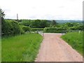
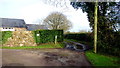
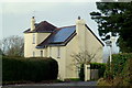
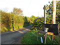
21 photos from this area
Area Information
Key information about the HR9 5RH including its size, population, and administrative classification.
- Area Type
- Postcode
- Area Size
- 13.6 hectares
- Population
- 1507
- Population Density
- 61 people/km²
House Prices in HR9 5RH
8
Properties
£582,500
Average Sold Price
£362,500
Lowest Price
£695,000
Highest Price
Showing 8 properties
| Address | Type | Beds | Baths | Last Sale Price | Last Sale Date | |
|---|---|---|---|---|---|---|
| Pen Y Bryn, Leys Hill Road, Leys Hill Walford, HR9 5RH | Bungalow | - | - | £690,000 | Jun 2021 | |
| Red Hall, Bulls Hill From B 4234 To Forest Green, Walford, HR9 5RH | Detached | - | - | £695,000 | Jul 2007 | |
| The Brow, Bulls Hill From B 4234 To Forest Green, Walford, HR9 5RH | Detached | - | - | £362,500 | May 2007 | |
| Tokio Cottage, Bulls Hill From B 4234 To Forest Green, Walford, HR9 5RH | Cottage | 3 | 2 | - | - | |
| The Cottage, Red Hall, Bulls Hill From B 4234 To Forest Green, Walford, HR9 5RH | undefined | - | - | - | - | |
| Cherry Orchard, Cherry Tree Lane, Walford, HR9 5RH | Detached | - | - | - | - | |
| Forest Lodge, Bulls Hill From B 4234 To Forest Green, Walford, HR9 5RH | Detached | - | - | - | - | |
| Westfield House, Bulls Hill From B 4234 To Forest Green, Walford, HR9 5RH | house | - | - | - | - |
Energy Efficiency in HR9 5RH
Amenities
Schools
| Rank | School | Type | Entry gender | Ages |
|---|
Explore more schools in this area
Go to Schools tabDemographics
Household Size
Two person
most common
Accommodation Type
Houses
most common
Tenure
80
majority
Ethnic Group
White
most common
Religion
N/A
most common
Household Composition
N/A
most common
Age
47
median
Adults (30-64 years)
most common
Household Deprivation
N/A
with no deprivation
NS-SEC
41
in Lower managerial occupations
Explore more demographic insights in this area
Go to Demographics tabPlanning
Planning Constraints
- Flood RiskPremium
- Ramsar Wetland SitesPremium
- Protected Nature ReservePremium
- Protected WoodlandPremium