Area Overview for HR9 5RA
Photos of HR9 5RA
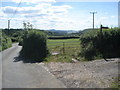
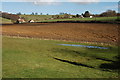
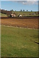
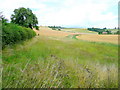
16 photos from this area
Area Information
Key information about the HR9 5RA including its size, population, and administrative classification.
- Area Type
- Postcode
- Area Size
- 72.6 hectares
- Population
- 1507
- Population Density
- 61 people/km²
House Prices in HR9 5RA
10
Properties
£404,500
Average Sold Price
£195,000
Lowest Price
£540,000
Highest Price
Showing 10 properties
| Address | Type | Beds | Baths | Last Sale Price | Last Sale Date | |
|---|---|---|---|---|---|---|
| Yew Tree Cottage, The Dean Road, Bishopswood, HR9 5RA | house | 3 | 2 | £540,000 | Jul 2024 | |
| Suff Lodge, The Dean Road, Bishopswood, HR9 5RA | house | - | - | £500,000 | Jun 2023 | |
| Atlas House, The Dean Road, Bishopswood, HR9 5RA | Cottage | 4 | 2 | £410,000 | Oct 2019 | |
| Rose Cottage, The Dean Road From B 4234 To Atlas House, Bishopswood, HR9 5RA | Cottage | 2 | 1 | £195,000 | Feb 2016 | |
| Wild Cherries, The Dean Road, Bishopswood, HR9 5RA | house | - | - | £377,500 | May 2011 | |
| Atlas Farm, The Dean Road, Bishopswood, HR9 5RA | house | - | - | - | - | |
| The Dam Barn, The Dean Road, Bishopswood, HR9 5RA | house | - | - | - | - | |
| Vine Tree Cottage, The Dean Road, Bishopswood, HR9 5RA | Detached | - | - | - | - | |
| The Forge Cottage, The Dean Road, Bishopswood, HR9 5RA | Detached | - | - | - | - | |
| Smithy Cottage, The Dean Road, Bishopswood, HR9 5RA | Detached | - | - | - | - |
Energy Efficiency in HR9 5RA
Amenities
Schools
| Rank | School | Type | Entry gender | Ages |
|---|
Explore more schools in this area
Go to Schools tabDemographics
Household Size
Two person
most common
Accommodation Type
Houses
most common
Tenure
80
majority
Ethnic Group
White
most common
Religion
N/A
most common
Household Composition
N/A
most common
Age
47
median
Adults (30-64 years)
most common
Household Deprivation
N/A
with no deprivation
NS-SEC
41
in Lower managerial occupations
Explore more demographic insights in this area
Go to Demographics tabPlanning
Planning Constraints
- Flood RiskPremium
- Ramsar Wetland SitesPremium
- Area of Outstanding Natural BeautyPremium
- Protected Nature ReservePremium
- Protected WoodlandPremium