Area Overview for HR8 9AT
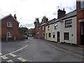
Photos of HR8 9AT


Area Information
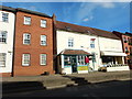
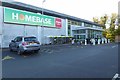
HR8 9AT is a small, tightly knit residential postcode area in England, home to 1714 residents. This compact cluster of homes is defined by its quiet, low-density character, with a population that reflects a mature demographic. The area is well-served by essential amenities, including two nearby railway stations—Ledbury and Colwall—offering straightforward access to regional transport networks. Locally, residents benefit from a range of retail options, including Spar, Tesco Ledbury, and Co-op Ledbury, which provide everyday convenience. While the area lacks sprawling urban infrastructure, its proximity to rail and retail makes it practical for daily life. The community here is likely to feel familiar, with a strong emphasis on local services and a manageable population size that avoids the congestion of larger towns. For those seeking a balance between rural tranquillity and accessible amenities, HR8 9AT offers a compact, functional living environment.
- Area Type
- Postcode
- Area Size
- Not available
- Population
- 1714
- Population Density
- 3500 people/km²
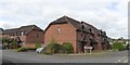
The property market in HR8 9AT is characterised by a 43% home ownership rate, suggesting that nearly half of residents rent their homes. The accommodation type is predominantly houses, which is unusual for areas with higher population densities but aligns with the small, rural nature of the postcode. This mix of ownership and rental properties may indicate a balance between long-term residents and those seeking temporary housing. The limited size of the area means that property availability is constrained, and buyers should consider the surrounding regions for broader options. For those prioritising family homes, the prevalence of houses may be appealing, though the relatively low ownership rate could signal a reliance on local rental markets. Prospective buyers should also note that the area’s small size may limit the diversity of property types available.
House Prices in HR8 9AT
No properties found in this postcode.
Energy Efficiency in HR8 9AT
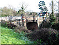
Daily life in HR8 9AT is shaped by its proximity to essential retail and transport hubs. The area’s shops—Spar, Tesco Ledbury, and Co-op Ledbury—offer a range of everyday goods, from groceries to household items, reducing the need for long trips to larger centres. These local stores contribute to a self-contained, practical lifestyle. The two nearby railway stations, Ledbury and Colwall, provide straightforward access to regional services, making commuting or weekend travel feasible. While the area lacks expansive parks or leisure facilities, its small size ensures that amenities are within walking or short driving distance. This compactness fosters a sense of convenience, where residents can meet daily needs without significant time or effort. The character of the area is defined by its quiet, functional approach to living, with a focus on accessibility over grandeur.
Amenities
Schools
| Rank | School | Type | Entry gender | Ages |
|---|
Explore more schools in this area
Go to Schools tabDemographics
The population of HR8 9AT is predominantly composed of adults aged 30–64, with a median age of 47. This suggests a community that is largely established, with a focus on stability and long-term residency. Home ownership in the area stands at 43%, indicating a mix of owner-occupied and rental properties. The accommodation type is primarily houses, which aligns with the area’s residential character. The predominant ethnic group is White, reflecting a demographic profile typical of many small English towns. While the data does not specify deprivation levels, the combination of a mature population and a relatively low population density implies a community that may prioritise family-oriented living. The absence of detailed diversity metrics means the area’s cultural composition remains largely unexplored in this context.
Household Size
Accommodation Type
Tenure
Ethnic Group
Religion
Household Composition
Age
Household Deprivation
NS-SEC
Explore more demographic insights in this area
Go to Demographics tabPlanning
Planning Constraints
- Flood RiskPremium
- Ramsar Wetland SitesPremium
- Area of Outstanding Natural BeautyPremium
- Protected Nature ReservePremium
- Protected WoodlandPremium
- Crime RiskPremium