Area Overview for HR8 2YG
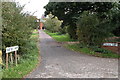
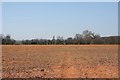
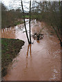
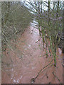
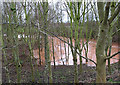
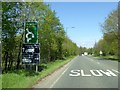
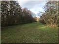
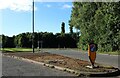
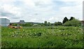
Photos of HR8 2YG


Area Information
HR8 2YG is a small, low-density postcode area in England with a population of 1681, spread across 45 people per square kilometre. It is a quiet, residential cluster characterised by a stable community of adults aged 30–64, with 73% of homes owned outright. The area’s compact size means it is ideal for those seeking a peaceful, family-oriented environment without the pressures of larger urban centres. Daily life here is shaped by proximity to local amenities, including two railway stations and a selection of retail outlets. The presence of Eastnor Parochial Primary School, rated outstanding by Ofsted, adds to the area’s appeal for families. While the population is small, the area’s infrastructure supports a self-contained lifestyle, with easy access to transport links and essential services. Its modest scale ensures a close-knit community feel, where neighbours are likely to be familiar faces. For buyers, HR8 2YG offers a blend of practicality and tranquillity, with homes predominantly in private ownership.
- Area Type
- Postcode
- Area Size
- Not available
- Population
- 1681
- Population Density
- 45 people/km²
The property market in HR8 2YG is dominated by owner-occupied homes, with 73% of properties in private hands. This contrasts with areas where rental demand drives the market, suggesting a focus on long-term residency rather than transient populations. The accommodation type is primarily houses, which aligns with the area’s low-density character and traditional housing stock. This makes HR8 2YG attractive to buyers seeking spacious, family-friendly homes, though the small size of the postcode means the housing stock is limited. Buyers may need to consider nearby areas for additional options. The high home ownership rate also indicates a stable market with minimal turnover, which can be reassuring for those seeking a secure investment.
House Prices in HR8 2YG
No properties found in this postcode.
Energy Efficiency in HR8 2YG
The lifestyle in HR8 2YG is shaped by its proximity to retail and transport hubs. Within practical reach are five retail outlets, including Aldi Ledbury, Co-op Ledbury, and Tesco Ledbury, offering a range of shopping options. These stores cater to daily needs, from groceries to household items, reducing the necessity for long trips. The two railway stations provide access to regional travel, enhancing connectivity for leisure or work. While the area lacks explicit references to parks or leisure facilities, the low population density implies open spaces may be available nearby. The combination of local shops and rail links fosters a convenient, self-sufficient lifestyle, ideal for those valuing accessibility and community amenities.
Amenities
Schools
The nearest school to HR8 2YG is Eastnor Parochial Primary School, which serves the area’s younger residents. This primary school has an outstanding Ofsted rating, reflecting high standards of education and care. The presence of a rated school is a significant draw for families, though the data does not mention secondary schools in the immediate vicinity. This means parents may need to look beyond HR8 2YG for secondary education options. The school’s proximity to homes in the area makes it a convenient choice for families, reducing the need for long commutes. The focus on primary education suggests the area is well-suited for younger families, though those requiring secondary schooling should investigate nearby towns or schools.
| Rank | School | Type | Entry gender | Ages |
|---|
Explore more schools in this area
Go to Schools tabDemographics
The population of HR8 2YG is predominantly adults aged 30–64, with a median age of 47. This suggests a mature, settled community with a strong presence of middle-aged families and professionals. Home ownership is high, at 73%, indicating a stable housing market with few rental properties. The area is composed mainly of houses rather than flats or apartments, reflecting a preference for traditional, spacious living. The predominant ethnic group is White, with no data provided on other demographics. The low population density of 45 people per square kilometre means the area is not densely populated, contributing to a relaxed, low-traffic environment. The age profile suggests a community with established careers and long-term residency, though younger families may find limited secondary school options nearby.
Household Size
Accommodation Type
Tenure
Ethnic Group
Religion
Household Composition
Age
Household Deprivation
NS-SEC
Explore more demographic insights in this area
Go to Demographics tabPlanning
Planning Constraints
- Flood RiskPremium
- Ramsar Wetland SitesPremium
- Area of Outstanding Natural BeautyPremium
- Protected Nature ReservePremium
- Protected WoodlandPremium